Thursday, August 9, 2007

Stonehenge

Saat manusia masih di zaman batu, bagaimana mereka bisa menyusun batu-batu raksasa itu?


Introduction

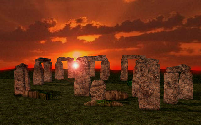
Stonehenge is a prehistoric monument located in the English county of Wiltshire, about 8 miles (13 km) north of Salisbury. One of the most famous prehistoric sites in the world, Stonehenge is composed of earthworks surrounding a circular setting of large standing stones. Archaeologists believe the standing stones were erected around 2200 BC and the surrounding circular earth bank and ditch, which constitute the earliest phase of the monument, have been dated to about 3100 BC. The site and its surroundings were added to the UNESCO's list of World Heritage Sites in 1986 in a co-listing with Avebury henge monument, and it is also a legally protected Scheduled Ancient Monument. Stonehenge itself is owned and managed by English Heritage while the surrounding land is owned by the National Trust.

Christopher Chippindale's Stonehenge Complete gives the derivation of Stonehenge as coming from the Old English words "stān" meaning "stone", and either "hencg" meaning "hinge" (because the stone lintels hinge on the upright stones) or "hen(c)en" meaning "gallows" or "instrument of torture". Stonehenge is a "henge monument" meaning that it consists of menhirs (large rocks) in a circular formation. Medieval gallows consisted of two uprights with a lintel joining them, resembling Stonehenge's trilithons, rather than looking like the inverted L-shape more familiar today.

The "henge" portion has given its name to a class of monuments known as henges. Archaeologists define henges as earthworks consisting of a circular banked enclosure with an internal ditch. As often happens in archaeological terminology, this is a holdover from antiquarian usage, and Stonehenge cannot in fact be truly classified as a henge site as its bank is inside its ditch. Despite being contemporary with true Neolithic henges and stone circles, Stonehenge is in many ways atypical. For example, its extant trilithons make it unique. Stonehenge is only distantly related to the other stones circles in the British Isles, such as the Ring of Brodgar.

Development of Stonehenge

Plan of Stonehenge today. After Cleal et al. and Pitts.

Plan of Stonehenge today. After Cleal et al. and Pitts.

The Stonehenge complex was built in several construction phases spanning 3,000 years, although there is evidence for activity both before and afterwards on the site.

Dating and understanding the various phases of activity at Stonehenge is not a simple task; it is complicated by poorly-kept early excavation records, surprisingly few accurate scientific dates and the disturbance of the natural chalk by periglacial effects and animal burrowing. The modern phasing most generally agreed by archaeologists is detailed below. Features mentioned in the text are numbered and shown on the plan, right, which illustrates the site as of 2004. The plan omits the trilithon lintels for clarity. Holes that no longer, or never, contained stones are shown as open circles and stones visible today are shown coloured.

Before the monument (8000 BC Forward)

Archaeologists have found four (or possibly five, although one may have been a natural tree throw large Mesolitic Postholes which date to around 8000 BC nearby, beneath the modern tourist car-park. These held pine posts around 0.75 m (2.4ft) in diameter which were erected and left to rot in situ. Three of the posts (and possibly four) were in an east-west alignment and may have had ritual significance; no parallels are known from Britain at the time but similar sites have been found in Scandinavia. At this time, Salisbury Plain was still wooded but four thousand years later, during the earlier Neolithic, a cursus monument was built 600 m north of the site as the first farmers began to clear the forest and exploit the area. Several other early Neolithic sites, a causedwayed encloseure at Robin Hood's Ball and Long Barrow tombs were built in the surrounding landscape.

Stonehege 1 (ca. 3100 BC)

Stonehenge 1. After Cleal et al.

Stonehenge 1. After Cleal et al.

The first monument consisted of a circular bank and ditch enclosure made of Late Cretaceous (Santonian Age) Seaford Chalk, (7 and 8) measuring around 110 m (360 feet) in diameter with a large entrance to the north east and a smaller one to the south (14). It stood in open grassland on a slightly sloping but not especially remarkable spot. The builders placed the bones of deer and oxen in the bottom of the ditch as well as some worked flint tools. The bones were considerably older than the antler picks used to dig the ditch and the people who buried them had looked after them for some time prior to burial. The ditch itself was continuous but had been dug in sections, like the ditches of the earlier causewayed enclosures in the area. The chalk dug from the ditch was piled up to form the bank. This first stage is dated to around 3100 BC after which the ditch began to silt up naturally and was not cleared out by the builders. Within the outer edge of the enclosed area was dug a circle of 56 pits, each around 1 m in diameter (13), known as the Aubrey holes after John Aubrey, the seventeenth century antiquarian who was thought to have first identified them. The pits may have contained standing timbers, creating a timber circle although there is no excavated evidence of them. A small outer bank beyond the ditch could also date to this period (9).

Stonehenge 2 (ca. 3000 BC)

Evidence of the second phase is no longer visible. It appears from the number of postholes dating to this period that some form of timber structure was built within the enclosure during the early 3rd millennium BC. Further standing timbers were placed at the northeast entrance and a parallel alignment of posts ran inwards from the southern entrance. The postholes are smaller than the Aubrey Holes, being only around 0.4 m in diameter and are much less regularly spaced. The bank was purposely reduced in height and the ditch continued to silt up. At least twenty-five of the Aubrey Holes are known to have contained later, intrusive, cremation burials dating to the two centuries after the monument's inception. It seems that whatever the holes' initial function, it changed to become a funerary one during Phase 2. Thirty further cremations were placed in the enclosure's ditch and at other points within the monument, mostly in the eastern half. Stonehenge is therefore interpreted as functioning as an enclosed cremation cemetery at this time, the earliest known cremation cemetery in the British Isles. Fragments of unburnt human bone have also been found in the ditch fill. Late Neolithic grooved ware pottery has been found in connection with the features from this phase providing dating evidence.

Stonehenge 3 I (ca. 2600 BC)

Archaeological excavation has indicated that around 2600 BC, timber was abandoned in favour of stone and two concentric crescents of holes (called the Q and R Holes) were dug in the centre of the site. Again, there is little firm dating evidence for this phase. The holes held up to 80 standing stones (shown blue on the plan) 43 of which were derived from the Preseli Hills, 250 km away in modern day Pembrokeshire in Wales. Other standing stones may well have been small sarsens, used later as lintels. The far-travelled stones, which weighed about four tons, consisted mostly of spotted Ordovician dolerite but included examples of rhyolite, tuff and volcanic and calcareous ash. Each measures around 2 m in height, between 1 m and 1.5 m wide and around 0.8 m thick. What was to become known as the Altar Stone (1), a six-ton specimen of green micaceous Silurian-Devonian sandstone, twice the height of the bluestones, is derived from either South Pembrokeshire or the Brecon Beacons and may have stood as a single large monolith.

The north eastern entrance was also widened at this time with the result that it precisely matched the direction of the midsummer sunrise and midwinter sunset of the period. This phase of the monument was abandoned unfinished however, the small standing stones were apparently removed and the Q and R holes purposefully backfilled. Even so, the monument appears to have eclipsed the site at Avebury in importance towards the end of this phase and the Amesbury Archer, found in 2002 three miles (5 km) to the south, would have seen the site in this state.

The Heelstone (5), a Tertiary sandstone, may also have been erected outside the north eastern entrance during this period although it cannot be securely dated and may have been installed at any time in phase 3. At first, a second stone, now no longer visible, joined it. Two, or possibly three, large portal stones were set up just inside the north eastern entrance of which only one, the fallen Slaughter Stone (4), 16 ft (4.9 m) long, now remains. Other features loosely dated to phase 3 include the four Station Stones (6), two of which stood atop mounds (2 and 3). The mounds are known as 'barrows' although they do not contain burials. The Avenue, (10), a parallel pair of ditches and banks leading 3 km to the River Avon was also added. Two ditches similar to Heelstone Ditch circling the Heelstone, which was by then reduced to a single monolith, were later dug around the Station Stones.

Stonehenge 3 II (2450 to 2100 BC)

The next major phase of activity at the tail end of the 3rd millennium BC saw 30 enormous Oligocene-Miocene sarsen stones (shown grey on the plan) brought from a quarry around 24 miles (40 km) north to the site on the Marlborough Downs. The stones were dressed and fashioned with mortise and tenon joints before 30 were erected as a 33 m (108 ft) diameter circle of standing stones with a 'lintel' of 30 stones resting on top. The lintels were joined to one another using another woodworking method, the tongue in groove joint. Each standing stone was around 4.1 m (13.5 feet) high, 2.1 m (7.5 feet) wide and weighed around 25 tons. Each had clearly been worked with the final effect in mind; the orthostats widen slightly towards the top in order that their perspective remains constant as they rise up from the ground while the lintel stones curve slightly to continue the circular appearance of the earlier monument. The sides of the stones that face inwards are smoother and more finely worked than the sides that face outwards. The average thickness of these stones is 1.1 m (3.75 feet) and the average distance between them is 1 m (3.5 feet). A total of 74 stones would have been needed to complete the circle and unless some of the sarsens were removed from the site, it would seem that the ring was left incomplete. Of the lintel stones, they are each around 3.2 m long (10.5 feet), 1 m (3.5 feet) wide and 0.8 m (2.75 feet) thick. The tops of the lintels are 4.9 m (16 feet) above the ground.

Within this circle stood five trilithons of dressed sarsen stone arranged in a horseshoe shape 13.7 m (45 feet) across with its open end facing north east. These huge stones, ten uprights and five lintels, weigh up to 50 tons each and were again linked using complex jointings. They are arranged symmetrically; the smallest pair of trilithons were around 6 m (20 feet) tall, the next pair a little higher and the largest, single trilithon in the south west corner would have been 7.3 m (24 feet) tall. Only one upright from the Great Trilithon still stands; 6.7 m (22 ft) is visible and a further 2.4 m (8 feet) is below ground.

The images of a 'dagger' and 14 'axe-heads' have been recorded carved on one of the sarsens, known as stone 53. Further axe-head carvings have been seen on the outer faces of stones known as numbers 3, 4, and 5. They are difficult to date but are morphologically similar to later Bronze Age weapons; recent laser scanning work on the carvings supports this interpretation. The pair of trilithons in north east are smallest, measuring around 6 m (20 feet) in height and the largest is the trilithon in the south west of the horseshoe is almost 7.5 m (24 feet) tall.

This ambitious phase is radiocarbon dated to between 2440 and 2100 BC.

Stonehenge 3 III

Later in the Bronze Age, the bluestones appear to have been re-erected for the first time, although the exact details of this period are still unclear. They were placed within the outer sarsen circle and at this time may have been trimmed in some way. A few have timber working-style cuts in them like the sarsens themselves, suggesting they may have been linked with lintels and part of a larger structure during this phase.

Stonehenge 3 IV (2280 BC to 1930 BC)

This phase saw further rearrangement of the bluestones as they were placed in a circle between the two settings of sarsens and in an oval in the very centre. Some archaeologists argue that some of the bluestones in this period were part of a second group brought from Wales. All the stones were well-spaced uprights without any of the linking lintels inferred in Stonehenge 3 III. The Altar Stone may have been moved within the oval and stood vertically. Although this would seem the most impressive phase of work, Stonehenge 3 IV was rather shabbily built compared to its immediate predecessors, the newly re-installed bluestones were not at all well founded and began to fall over. However, only minor changes were made after this phase. Stonehenge 3 IV dates from 2280 to 1930 BC.

Stonehenge 3 V (2280 BC to 1930 BC)

Soon afterwards, the north eastern section of the Phase 3 IV Bluestone circle was removed, creating a horseshoe-shaped setting termed the Bluestone Horseshoe. This mirrored the shape of the central sarsen Trilithons and dates from 2270 to 1930 BC. This phase is contemporary with the famous Seahenge site in Norfolk.

After the monument (1600 BC on)

Even though the last known construction of Stonehenge was about 1600 BC, and the last known usage of it was during the Iron Age (if not as late as the 7th century), where Roman coins, prehistoric pottery, an unusual bone point and a skeleton of a young male (780-410 cal BC) were found, we have no idea if Stonehenge was in continuous use or exactly how it was used. Notable is the late 7th-6th century BC large arcing Scroll Trench which deepens E-NE towards Heelstone, and the burial of a decapitated Saxon man excavated from Stonehenge dated to the 7th century. The site was known by scholars during the Middle Ages and since then it has been studied and adopted by numerous different groups.

Myths and legends

The Heelstone

The Heelstone

"Friar's Heel" or "Sunday Stone"

The Heel Stone was once known as “Friar’s Heel”. A folk tale, which cannot be dated earlier than the seventeenth century, relates the origin of the name of this stone:

The Devil bought the stones from a woman in Ireland, wrapped them up, and brought them to Salisbury plain. One of the stones fell into the Avon, the rest were carried to the plain. The Devil then cried out, “No-one will ever find out how these stones came here.” A friar replied, “That’s what you think!,” whereupon the Devil threw one of the stones at him and struck him on the heel. The stone stuck in the ground and is still there.

Some claim “Friar’s Heel” is a corruption of “Freyja’s He-ol” or “Freyja Sul”, from the Nordic goddess Freyja and (allegedly) the Welsh words for “way” and “Friday” respectively.

Arthurian Legend

A giant helps Merlin build Stonehenge. From a manuscript of the Brut by Wace in the British Library (Egerton 3028). This is the oldest known depiction of Stonehenge.


Stonehenge is also mentioned within Arthurian legend. Geoffrey of Monmouth said that Merlin the wizard directed its removal from Ireland, where it had been constructed on Mount Killaraus by Giants, who brought the stones from Africa. After it had been rebuilt near Amesbury, Geoffrey further narrates how first Ambrosius Aurelianus, then Uther Pendragon, and finally Constantine III, were buried inside the ring of stones. In many places in his Historia Regum Britanniae Geoffrey mixes British legend and his own imagination; it is intriguing that he connects Ambrosius Aurelianus with this prehistoric monument, seeing how there is place-name evidence to connect Ambrosius with nearby Amesbury.

According to Geoffrey of Monmouth, the rocks of Stonehenge were healing rocks which Giants brought from Africa to Ireland for their healing properties. Aurelius Ambrosias (5th Century), wishing to erect a memorial to the nobles (3000) who had died in battle with the Saxons and were buried at Salisbury, chose (at Merlin's advice) Stonehenge to be their monument. So the King sent Merlin, Uther Pendragon (Arthur's father), and 15,000 knights to Ireland to retrieve the rocks. They slew 7,000 Irish. As the knights tried to move the rocks with ropes and force, they failed. Then Merlin, using "gear" and skill, easily dismantled the stones and sent them over to Britain, where Stonehenge was dedicated. Shortly after, Aurelius died and was buried within the Stonehenge monument, or "The Giants' Ring of Stonehenge".

Recent History

Photograph of Stonehenge taken July 1877

Photograph of Stonehenge taken July 1877
The sun rising over Stonehenge on the summer solstice on 21 June 2005


By the beginning of the 20th century a number of the stones had fallen or were leaning precariously, probably due to the increase in curious visitors clambering on them during the nineteenth century. Three phases of conservation work were undertaken which righted some unstable or fallen stones and carefully replaced them in their original positions using information from antiquarian drawings.

In 1915 Cecil Chubb bought Stonehenge, through Knight Frank & Rutley estate agents, for £6,000 as a present for his wife. She gave it to the nation three years later. The item was listed in the catalogue as "Lot 15. Stonehenge with about 30 acres, 2 rods, 37 perches of adjoining downland."[1]

Stonehenge is a place of pilgrimage for neo-druids and those following pagan or neo-pagan beliefs. The midsummer sunrise began attracting modern visitors in the 1870s, with the first record of recreated Druidic practices dating to 1905 when the Ancient Order of Druids enacted a ceremony. Despite efforts by archaeologists and historians to stress the differences between the Iron Age Druidic religion and the much older monument, Stonehenge has become increasingly, almost inextricably, associated with British Druidism, Neo Paganism and New Age philosophy. After the Battle of the Beanfield in 1985 this use of the site was stopped for several years, and currently ritual use of Stonehenge is carefully controlled.

In more recent years, the setting of the monument has been affected by the proximity of the A303 road between Amesbury and Winterbourne Stoke, and the A344. In early 2003, the Department for Transport announced that the A303 would be upgraded, including the construction of the Stonehenge road tunnel. The controversial plans have not yet been finalised by the government.



Crop Circle

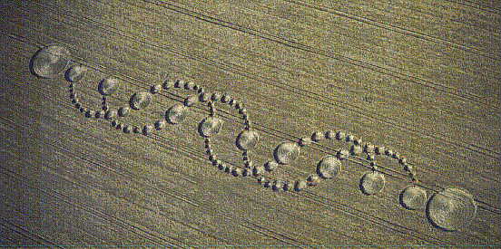
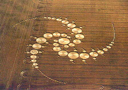
Kesimetrisan yang sempurna, di buat dengan waktu yang begitu cepat tanpa seorang pun berhasil menyaksikan proses terbentuknya lukisan-lusiksan itu, keindahan yang mengagumkan, kemisterian yang mencekam, dan tak seorang pun terbukti sanggup membuatnya. Lalu siapa yang membuatnya dan apa tujuannya?

Introduction

Crop Circles - formations, usually found in grain crops, where the crop has been mysteriously found laid flat, in patterns, that did not exist in daylight the previous day.

Although thought by many to be a phenomena of the 20th Century, crop circles and formations have been around for a very long time, and records even date back well before the invention of the camera.

The most well known positive depiction of a crop circle is found in a woodcut made in 1678 with the title 'Strange News out of Hartford-shire’.
It depicts a devil-like creature cutting out a pattern in a crop with a scythe.
The woodcut has text, which told of a greedy farmer, who, having refused to pay a mower a reasonable rate for reaping his oats, swore that he would rather have the Devil do the work. The very following morning, the farmer awoke to find his crop had been harvested, but done so in such an amazing manner, with rounded circles of incredible exactness that no human could have done the same within the period and darkness of one night. The farmer was so afraid that he could not enter the field to collect his harvest.

It is suggested by some cryptologists and others that crop circles are depicted in prehistoric stone and wall carvings, such as in the spiral patterns carved in a stone at Newgrange in Ireland. For those that hold the view that crop circles are created by extra-terrestrials in spacecraft, some would say that reasonable recorded proof of this is depicted in some ancient Egyptian pictures.

The recorded incidence of crop circles in more modern times seems to have started in the early 20th century, with a gradual increase in numbers through to a marked incr4ease in the 1960’s, leading to a quite dramatic upturn in the 1990’s. At least 190 formations were discovered and documented in 1999, perhaps an omen for what is to come in the new millennium.

There are many who are under the impression that crop circles are only indigenous to the U.K. Sure, they are more prevalent here than elsewhere in the world, but there are countless examples of them appearing all over the world - in the USA from 1920, in Europe from the mid 20th century and in Africa, Canada, Australia, Central & Southern America, Russia in 1970, and Japan in the late 70’s.

Many visitors to the U.K. are amazed to discover that crop circles actually appear in their own country.

What odds, that formations in the 21st century will be found on the surface of the Moon and Mars, and beyond?

The Crop Circles Phenomenon

In the seventies mysterious circles appeared in various crops in England. They immediately caught the public's attention. As these circles appeared year after year, got more sophisticated and spread to ever more areas a broad range of people got interested in studying and explaining this phenomenon. They range from scientists of various disciplines to New Age and UFO enthusiasts.

Trying to explain the mystery of the crop circles several theories were presented. In the eighties Dr. Terrence Meaden attempted to explain the spiral patterns occurring in crop circles as the result of atmospheric phenomena present, for instance, in the vortex of a dust devil or tornado. Had Dr. Meaden ever seen a dust devil or a tornado he would have thought otherwise.

In Phoenix, Arizona, the evening news regularly brings pictures of dust devils dancing over the desert floor. I intentionally say dancing because they are not moving in a straight line. Dust devils are pockets of circular movements within the general wind direction. This wind has gusts impacting on the dust devil moving it forth and back sideways and changing its shape. - A dust devil does not produce perfectly round circles and it does not put things flat on the ground. It picks up sand, which becomes the body of the dust devil.

A tornado is the most destructive force of winds on the Earth. It picks up everything in its way: houses, people, cows, cars, trees, etc. A tornado doesn't put anything flat on the ground. It rips everything out of the ground and carries it away. The same holds true for another kind of whirlwind, hurricanes. If something cannot be carried away it is smashed or stripped; for instance, trees are stripped of their leaves.

If an atmospheric force were responsible for crop circle formation the stalks would be pulled out of the ground. If the stalks remained in the round they would be stripped of leaves and grains and broken in between the nodes. Such force would leave behind a mess, not nicely aligned intact stalks. Furthermore, all these atmospheric forces have a lateral movement, which is very forceful and will result in a path of destruction not in an orderly circle.

Another approach comes from the proponents of the so-called Gaia hypothesis. Crop circles frequently appear near ley-lines or places where ancient structures are found such as Stonehenge, Avebury, Salisbury etc. These cites are thought to have spiritual significance and, therefore, people believe these circles could be the expression of the collective Earth soul expressing its disgust with the present situation on the planet and indicating that all forms of consciousness should be realigned in a new direction.

I am at a loss to accept that the Earth has a collective consciousness that would and could express itself in crop circles. There is an explanation why such circles show up near ancient sites and at ley-lines but it has nothing to do with an earth collective consciousness and a re-alignment of whatever kind. I'll deal with this later in the article.

If science cannot explain something usually it is declared a hoax. This opinion got a boost when two retired men came forward in the early nineties and claimed they had made the crop circles. Remarkably, this claim appeared simultaneously on CNN and a number of top international newspapers like the Wallstreet Journal, The New York Times, and European papers like the eminent French publication "Le Figaro".

The above scenario seems quite suspicious. It is practically impossible to appear on CNN or on any other main stream publication with a topic as far out as crop circles. That this happened in a timely coordinated fashion indicates that someone with a lot of clout was behind this action. Probably the crop circles had stirred up enough interest and enough credibility that the public began to take them seriously, which translated into a world- wide security problem. Probably several governments got together and decided that anything in connection with them had to be discredited. - The plan worked. After this sensational "confession" interest in crop circles was non-existent in scientific circles and the topic was dead for all main stream media.

It is interesting to note that no group of any importance made a serious attempt to verify the old men's claims or to counter them. Sure, they could have made a number of circles but there were so many in so many locations that two old men with strings and a board could not have made all of them. Furthermore, this method leaves chafing and other mechanical marks on the stalks and the stalks would be bent in a characteristic way, which would show clearly a difference to other sites where a different method was used. It would have been easy to investigate and to find out how many of the sites really show the characteristics of manual creation of the crop circles.

Having dealt with the above theories it remains to assess the peculiar characteristics common to crop circles:
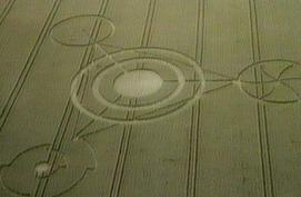
Crop circles have evolved over time. While initially they were just that, circles, straight lines were added as a next step. Intricate patterns with several circles and straight lines followed and as of lately complicated patterns with sometimes sophisticated formations integrating mathematical formulas within the circles have shown up. There are pictograms with signs sacred to various peoples the world over. It seems impossible to create such formations in a single night by hand. In fact, many of the recent crop images look like computer created art.

The bases of a crop image are bent stalks in various kinds of crops. They appear mostly in barley and wheat but can also be found in canola and grass, even on sand and snow. They have been reported from all over the world. Frequently they show up on ley-lines or near ancient sites.

The stalks can be bent in any direction in the same image. Sometimes they have several layers with the stalks bent in different directions. In the UK bent stalks have been noticed that look like woven in a pattern. The bending itself is done at the nodes. This is very peculiar as the nodes give plants their strength. They normally bend between the nodes.

Nodes keep a plant upright because they gather water and the water's pressure in the nodes makes the stalk rigid. In crop images plants bend because the nodes were dehydrated. There is a hole in the node, which looks like an outlet for water vapor that formed after intense heating. Most remarkably, the nodes are bent selectively. They can be bent at the lowest knuckle or at any other one higher up the stalk. Nodes in different parts of a crop image can be bent at different heights in different directions within the same formation. Also, as the crop continues to grow an image can take on a different appearance.

Often the crop images are set inside a field away from tramlines with no visible access. They also show up in fenced off restricted military areas. Plants in the affected areas look dehydrated and cells are enlarged. Soil samples tested by Colin Andrews yielded up to 100 % higher than normal EM measurements in the centers of the formations tested. There are reports that in the years following the appearance of the crop circle the affected areas had an increase in crop yield of up to 40%.

There is residual radiation in the circles, which can have adverse effects. Measurements have detected an emission of energy at the 5KHz frequency up to several days after the crop circles were formed. This frequency lies within the audible range and some hear a "trilling sound". Many people show physical reactions after visiting crop circles. The symptoms are nausea, headaches, dizziness, tingling sensations and various pains. These symptoms are consistent with health problems from radiation. Mobile phones, cameras, watches and especially electronic equipment brought in to check the circles have failed and compasses on airplanes flying overhead have been reported spinning out of control.

People watching crop circles being formed noticed a reddish glow at ground level. The bending of the vegetation was done in a few minutes. Nobody saw anyone doing the bending or any kind of device or craft hovering above the site. Jaques F. Vallee, a renowned researcher of UFO's and other phenomena many years ago gave a lecture at Oxford University where he met a young man whose hobby was to fly gliders over the English countryside. One sunny afternoon this young man encountered something that looked like a metallic cylinder hanging motionless in the air and showing a reflection of his glider. The young man circled the object several times. As there was no action he left.

A reddish glow and the formation of a pictogram within a few minutes as well as the symptoms displayed by the nodes of the bent stalks are consistent with microwave or similar radiation. Such radiation raises the temperature in the nodes targeted. When the water in the nodes vaporizes steam is created, which expands and busts the node open. With the water pressure inside the node gone and a hole in the node the plant loses its support and bends over.

Even more amazing than this very sophisticated method for forming crop circles is the fact that nodes can be individually targeted. The direction of the bends as well as the height of the nodes affected can change within the same pictogram, which can yield very sophisticated formations. This is irrefutable evidence that the images in crop circles are formed by some kind of a controlling device like a computer, which issues commands for another device that emits radiation impacting on the plants. - Spheres of about 1 foot in diameter hovering over areas where crop circles were forming have been repeatedly observed. - Many designs look like computer created graphics. In fact, some designs are so complex and spiked with mathematical information that only a computer could have created them. Other designs depict sacred symbols from many different peoples all over the world.

There is evidence that the crop circle producers react to comments and attempts to dismiss the crop circle phenomenon by promptly producing circles, which invalidate objections. This raises the question: how do they get to know about that? The only way to really know what's going on without being there is to telepathically retrieve this information from people talking about this subject. This adds another dimension to the concern about these activities because it implies that the producers of crop circles know exactly what goes on in the minds of people dealing with this phenomenon. They will always be a step ahead of possible opponents.

Crop circles were found on fenced off military grounds and some believe that this proves that the military is conducting tests with secret radiation weapons aimed at destroying enemy crops. - Development of new weapons is always conducted in secrecy. There is nothing secret about the crop circles. Moreover, crop circles can be found all over the world. Why and how would the British military go to all these places and trespass on foreign private property to test a secret weapon? This is as absurd as assuming that two old men with a string and a board could penetrate fenced off tightly guarded military installations to make crop circles.

Crop circles on fenced off guarded military grounds must be done by someone the military neither detects nor can keep out of its protected area. Even if such an intruder only produces pictograms this must be reason of major concerns for the military. What if this intruder decides to do something a lot more sinister and unfriendly than producing crop circles? The military for sure is aware of the implications of crop circles popping up in restricted areas.

Another concern for governments all over the world where crop circles have shown up must be the fact that somebody has the technical means to produce very sophisticated pictograms all over the world and nobody knows who it is and what the purpose of these pictograms is. There are signs that the British government is conducting a Dis-information campaign and has taken measures to disrupt the work of the crop circle producers but it is not working. As these pictograms establish spiritual patterns the only way to invalidate their meaning would be to blow them apart with a helicopter hovering overhead or a wind machine. To make matters worse the film industry addressed this topic in a recent movie and the general public has become aware of the situation. Rightfully, safety concerns will be raised if this issue cannot be resolved.

Crop circles initially appeared in the English countryside in the seventies and gradually spread over most of the world. Having excluded hoaxters, Earth consciousness and secret military activities several conclusions can be drawn. Whoever produces crop circles puts a lot of time and effort in this activity. Whoever is doing this has responded to clumsy attempts of hoaxters and scientific investigators to produce crop circles with ever more sophisticated designs that cannot be duplicated within the time frame such circles appear, which is in a single night. Whoever is behind the crop circles phenomenon has a plan and is determined to implement this plan.

We must assume that the crop circle producers possess the means to document their presence all over the world and to do whatever they please without being detected or hampered in their activities. This presupposes unlimited mobility and a degree of technical sophistication that surpasses the capabilities of anybody even of the governments whose countries are leaders in scientific progress. Furthermore, neither does it make sense that a government engages in this type of activity nor could it be kept secret because the phenomenon is so wide spread. So, who is really producing the crop circles and why?

Crop circles are not the first to be spread very far over the planet. There is a precedent and it goes back thousands of years to the time when megaliths were erected on this planet's surface. The parallels between the two phenomena need to be explained in order to link them credibly.

Approximately 5500 years ago aliens who called themselves the gods invaded this planet. Their temporary presence on this planet is well-documented in religions, temples and related structures the world over. Irrefutable proof that they existed is etched in the stones of Ica. These stones show human like people performing surgical operations we know of and are able to perform only lately like heart and other organ transplants. Some stones show brain surgery and brain transplants. At that time humans for sure were not able to perform such advanced medical surgeries and brain transplants humans still can't do. Therefore, the people shown on the stones are gods. These stones also show dinosaurs and humans interacting with them.

While the stones of Ica cannot be carbon dated clay figurines found at Acambaro in Mexico, which also show dinosaurs and humans interacting, can. The dates range from 4500 to 1100 BC. Greek legends tell of a devastating flood only one god and his wife survived. That's why they call it Deukalion's flood. This event occurred about 1500 BC and at that time several other major catastrophes wreaked havoc in the Mediterranean and many other places on the planet. After that date there were no gods and no dinosaurs. Even the vegetation changed dramatically. Paradise, the parallel world, was lost. The present world with all its shortcomings was firmly established.

Before the big change megaliths were the preferred building method. The gods were able to handle stone slabs up to a thousand tons as shown in the Trilithon at Baalbek in Lebanon, at various sites in Peru and in many other places. Therefore, it makes sense to assume that the gods were the ones who erected megalithic structures in many areas of this planet. Aside from pyramids and temples there are structures like Stonehenge and Carnac as well as more than 50,000 simple megalithic locations all over the world especially in England and France. It required a major effort over an extended period of time to establish a megalithic landscape. So, what was the motivation? Is there a relation between the megaliths, which were erected in a time span of about thousand years before the big change, and the ensuing dramatic change?

The answer to this important question can be found in the way gods conducted their business. Religion - spirituality - was most important to them. A major endeavor like placing megaliths over much of the planet for sure had spiritual purposes. The gods erected pyramids and spiritually connected them to the heavens to add more weight to their spiritual claims, for instance, the Pyramids of the Sun and of the Moon in Mexico.

The most remarkable structure serving a spiritual purpose was and still is the Great Pyramid at Giza. It is the centerpiece not only of the pyramids on the plateau but of all the pyramids found in Egypt. The Pyramids of Giza are aligned exactly like the stars in Orion's belt. Also, the position of the pyramids of Giza correlates to the meridian axis of the Nile like the stars of Orion's belt correlate to the meridian axis of the Milky Way thus integrating the Milky Way into the spiritual equation of the Egyptian gods. The sheer weight of these pyramids and the spiritual weight of the cosmic objects they represent gave greatest weight to the spiritual claims of the Egyptian gods and, thus, dominance over the claims of the other gods. - A

The structures at Stonehenge started out about 2900 BC, several hundred years earlier than the pyramids of the Giza plateau. When these pyramids were built around 2500 BC Stonehenge was transformed from a wooden structure to a megalithic structure. Stones from 4 to 50 tons were hauled over great distances in successive phases and by 1600 BC Stonehenge had reached its final appearance. There were no changes after this date.

During the time when Stonehenge was turned into a megalithic structure megaliths were erected all over England, France and over most of the planet. Remarkably, most of the megaliths were located on ley-lines or at the crossings of such lines where frequently religious structures or ancient ruins of temples can be found. This is a clear indication that the megaliths served spiritual purposes because the ley-lines are the expression of the energies of the quantum vacuum also called spiritual energies, which spread in a grid-like pattern all over the planet. This is the best way to establish spiritually valid patterns and mechanisms.

All megalithic sites correspond to stars or star systems. The Ordnance maps of ancient Scotland, Britain and Ireland show that the megaliths are map projections of the northern and southern hemispheres of the sky and their stars and star systems. The megaliths not only have markings telling which star or star system they represent, in sites representing a star cluster the stones vary in size and weight in proportion to the stars of the star system and are placed at distances reflecting the distances between the stars. Also, the color of the stones reflects the color of the stars they represent. Big red stones, for instance, represent Red giants. - Megaliths not only represent the heavens, they also were used for geodetic and surveying purposes all over the planet. To this day megaliths exist that mark county borders in England.

The megalithic scenery provides very interesting information:

  • The people who erected the megalithic sites were able to move stones that weighed dozens of tones and knew how to fashion them to their needs.
  • They were experts in astronomy.
  • They were experts in geodesics and surveying.
  • They could travel all over the planet because this was the only way to map the northern and southern sky and to erect more than 50,000 megaliths.
  • They were able to make a determined and sustained effort over many years.
  • They were able to coordinate this immense project on a planet wide basis.
  • Humans of early times definitely were not able to get this work done.
  • The only ones who qualify as producers of the megaliths are the gods of antiquity. Judging from the way they conducted themselves in those remote times it would be a terrible disaster for mankind if the gods succeeded to come back and to live on this planet.

Megaliths like the pyramids in Egypt were part of the effort to establish the spiritual basis for a change of worlds. When the big change came something went terribly wrong for the gods because they are not around any more. The ones on the surface of the planet died. Only the ones in space ships at the time of the change survived. After the change they went into a time dilation flight and, therefore, they are still alive. Lately, they appeared again - we know their space ships as UFOs.

There are several parallels between megaliths and crop circles:
they can be found over most of the planet. Stonehenge was the center of the megalithic scenery. That's where the first crop circles appeared. That's also the area where the most sophisticated patterns are found. The megaliths were part of a huge endeavor to program spiritual energies in preparation for the coming change of worlds. Obviously, the crop pictograms serve the same purpose.

Assuming that the crop circles serve the same purpose as the megaliths the connection between the ley-lines, megaliths, ancient sites and the crop circles becomes obvious. Much of the ancient network of megaliths is still around. The crop circles may be a brand new effort to program the spiritual energies of this planet or they mend megaliths based spiritual situations that weathering and human actions destroyed over time. They are part of a determined, coordinated and sustained effort all over the planet. Their appearance shows a degree of technical sophistication that clearly reflects the same plan and methods as used when the megaliths were erected. - The gods are back and they are programming a change of worlds again.

Weight is the one major difference between crop circles and megaliths and there is a simple explanation for this. In the world before there were several clans of gods hostile to one another. Each clan wanted to make sure that its own spiritual claims carried the most weight. In this world there are no gods at all. Only one clan of gods is around trying to establish the spiritual patterns that enable it to invade this planet again and its members live in space ships. Therefore, the tools for programming need not to be heavy. Crop circles are adequate.

When the previous change of worlds came a thousand years of preparation failed to ensure the survival of the gods who had prepared this change. Another kind of gods was at work and made sure that this is a world for humans only and we know who these gods were.

The Edda is the Saga of the Scandinavian people telling of fights between two kinds of gods, the good ones and the evil ones. The evil gods called the Aesir fought the good gods called the Vanir. The Edda predicted the end of the evil gods and the re-appearance of the good gods after the cataclysm, which will accompany the imminent change of worlds. The Edda also says that the evil gods feared the good gods - with valid reasons.

While the former change of worlds brought the end of the evil Aesir gods in physical form the coming change will bring the total annihilation of these gods because the coming world has been announced by Jesus of Nazareth as a world of love and peace. This means that this will be a positive world. Nothing evil or negative can enter this world.

The megaliths could not ensure the victory of their creators. Neither will the spiritual programming done with crop circles ensure the victory of their makers who will disappear just like crop circles do when the crop is cut and the fields are plowed over.


Monday, August 6, 2007

Nazca Lines

Bila memang mereka yang menciptakannya,
Lalu mengapa mereka membuat suatu karya seni yang mereka sendiri tidak bisa menikmatinya?

Stretching across the Nazca plains like a giant map or blueprint left by ancient astronauts, lie the famous Nazca Lines of Peru. Peru is associated with the Incan Civilization who many link with alien visitors who still interact with local people to this day.

The Nazca Lines are an engima. No one has proof who built them or why. Since their discovery, the Nazca Lines have inspired fantastic explanations from ancient gods, a landing strip for returning aliens, a celestial calendar created by the ancient Nazca civilization -- putting the creation of the lines between 200 BC and 600 AD, used for rituals probably related to astronomy, to confirm the ayllus or clans who made up the population and to determine through ritual their economic functions held up by reciprocity and redistribution, or a map of underground water supplies.

There are also huge geoglyphs in Egypt, Malta, United States (Mississippi and California), Chile, Bolivia and in other countries. But the Nazca geoglyphs, because of their numbers, characteristics, dimensions and cultural continuity, as they were made and remade through out the whole prehispanic period, form the most impressive, as well as enigmatic, archeological group.

Location

The Nazca Lines are located in the Nazca Desert, a high arid plateau that stretches between the towns of Nazca and Palpa on the pampa (a large flat area of southern Peru). The desolate plain of the Peruvian coast which comprises the Pampas of San Jose (Jumana), Socos, El Ingenio and others in the province of Nasca, is 400 Km. South of Lima, covers an area of approximately 450 km2, of sandy desert as well as the slopes of the contours of the Andes. They cover nearly 400 square miles of desert. Etched in the surface of the desert pampa sand about 300 hundred figures made of straight lines, geometric shapes most clearly visible from the air.

Nazca Plain

The Nazca plain is virtually unique for its ability to preserve the markings upon it, due to the combination of the climate (one of the driest on Earth, with only twenty minutes of rainfall per year) and the flat, stony ground which minimises the effect of the wind at ground level. With no dust or sand to cover the plain, and little rain or wind to erode it, lines drawn here tend to stay drawn. These factors, combined with the existence of a lighter-coloured subsoil beneath the desert crust, provide a vast writing pad that is ideally suited to the artist who wants to leave his mark for eternity.

The pebbles which cover the surface of the desert contain ferrous oxide. The exposure of centuries has given them a dark patina. When the gravel is removed, they contrast with the color underneath. In this way the lines were drawn as furrows of a lighter color, even though in some cases they became prints. In other cases, the stones defining the lines and drawings form small lateral humps of different sizes. Some drawings, especially the early ones, were made by removing the stones and gravel from their contours and in this way the figures stood out in high relief.

The concentration and juxtaposition of the lines and drawings leave no doubt that they required intensive long-term labor as is demonstrated by the stylistic continuity of the designs, which clearly correspond to the different stages of cultural changes.

Designs, Myths and Metaphors

There appear to be various designs consisting of figures of animals, flowers and plants, objects, and anthropomorphic figures of colossal proportions made with well-defined lines. An example of this is the drawing of a weird being with two enormous hands, one normal and the other with only four fingers.


Gray Alien hand vs. Human Hand?

Also represented are drawings of man-made objects such as yarn, looms and "tupus" (ornamental clasps). All these figures have well-defined entrances which could be used as paths or to allow people to line together along the conformations of the drawings.

The anthropomorphic figures are relatively few and are situated on the slopes. The most well-known being is The Astronaut at 32m length discovered by Eduardo Herran in 1982.


Ancient Astronaut?

The lines are many kilometers long and crisscross sectors of the pampas in all directions. Many of the lines form geometric figures: angles, triangles, bunches, spirals, rectangles, wavy lines, concentric circles.


X - Hourglass? Programmed in Time?

Satellite Image NASA


Spiral of consciousness? Sacred Geometry?


The Monkey has a Spiraling Tail
The creation/evolution of the human biogentic experiment?


A Dog? Creatures with 4 legs?


Amphibious Gods? Creation from the Sea?


Headless Bird


Bird Headed Being


Six-petal Flower of Life?


Sacred Flame? 3=third dimension?


Trapezoidal designs - Pyramid design pointing above?

Map

1. Killer Whale
2. Wing
3. Baby Condor
4. Bird
5. Animal
6. Spiral
7. Lizard
8. Tree
9. Hands
10. Spiral
11. Spider
12. Flower
13. Dog
14. Astronaut
15. Triangle
16. Whale
17. Trapazoids
18. Star
19. Pelican
20. Bird
21. Trapazoid
22. Hummingbird
23. Trapezoid
24. Monkey
25. Llama
26. Trapezoids


Composition

The Lines were allegedly made by removing the iron-oxide coated pebbles which cover the surface of the desert. When the gravel is removed, they contrast with the light color underneath. In this way the lines were drawn as furrows of a lighter color. Off the Pampa, south of the Nazca Lines, archaeologists have now uncovered the lost city of the line-builders, Cahuachi. It was built nearly 2,000 years ago and mysteriously abandoned 500 years later.

Discovering the Nazca Lines by Outsiders

The Nazca Lines were first spotted when commercial airlines began flying across the Peruvian desert in the 1920's. Passengers reported seeing 'primitive landing strips' on the ground below. Today people sometimes fly in hot air balloons to view the splendors of the Nazca Lines, their eneries awakening something within their souls.

Nazca People - Cahuachi

On the pampa, south of the Nazca Lines, archaeologists have now uncovered the lost city of the line-builders, Cahuachi. It was built nearly two thousand years ago and was mysteriously abandoned 500 years later. New discoveries at Cahuachi are at last beginning to give us insight into the Nazca people and to unravel the mystery of the Nasca Lines.

In general, Nazca culture is considered to consist of three stages; Early, Middle, and Late stages, and also the Classic Nazca (approximately A.D. 250-750). One of the most famous and distinctive features of the Nazca culture is the polychrome pottery which has attracted attention because of its technological refinement and the exciting symbolism of its motifs. This pottery culture spreads in the area of the valleys of Chincha, Pisco, Ica, Nazca and Acari.

In the Early stage, these wares did not have much color, but Middle and Late Nazca polychromes are buff or red and are painted in three to eight colors. The most popular choices of color were red, black, white, brown, yellow, gray and violet with an outline in black. Bowls and beakers were common forms, but double-spout and head-and-spout jars are also found. Birds, fish or fruits were commonly drawn on the pottery, and Nazca's religious or mythological features were also used in its design.


Nazca Figurine depicting Solar Eclips and the eye of Creation.

Cahuachi was a major ceremonial center of the Nazca culture and overlooked some of the Nazca lines from 1 CE to about 500 CE. Italian archaeologist Giuseppe Orefici has been excavating the site for the past few decades, bringing a team down every year. The site contains over 40 mounds topped with adobe structures.

The permanent population was quite small, but it was apparently a pilgrimage center that grew greatly in population for major ceremonial events. These events probably involved the Nazca lines and the giant sand dune of Nazca. Support for the pilgrimage theory comes from archaeological evidence of sparse population at Cahuachi and from the Nazca lines themselves which show creatures such as killer whales and monkeys which were not present in the Nazca region. Trade or travel may explain the images. Due to the dry climate the finds are quite rich and include even such ephemeral material as clothing. Looting is the greatest problem facing the site today.

Weaving

Burial Sites

Most of the burial sites surrounding Cahuachi were not known until recently and so present a very tempting target for archaeologists. Their ancient technique of weaving, that the Nazca people developed, has given an insight into how the lines may have been made, and what they might have been used for more than 1,500 years ago.

Mummies

Most exciting is the discovery of human remains.

Stunningly preserved in the dry soil of the Peruvian desert are the mummified bodies of the Nazcan people themselves.


Nazca Skulls with Enlarged cranium


Originally believed to have been a military stronghold, Cahuachi is now reckoned to be a place of ritual and ceremony, and Orefici's stunning new evidence confirms this idea. Cahuachi is now revealed to have been abandoned after a series of natural disasters destroyed the city. But before they left it, the Nazcan people covered the city in the arid pampa sand where, until recently, it has remained a barely visible mound in the desert.

Preserving the Nazca Lines

It is difficult to keep the Nazca Lines free from outside intervention. As with all ancient ruins, such as Machu Piccu, weather by wind and rain, and human tampering will take their toll on these ancient Lines.

In recent years the Nazca Lines have suffered gradual destruction, as tomb raiders seeking pre-Inca artifacts scar the terrain with hundreds of burrows, garbage, among other waste material. A boom in copper and gold mining - including a mine built in 1997 a few feet from a 2,000-year-old, two-mile-long trapezoid -- is defacing parts of the Nazca Lines with tracks from truck traffic.

Over the past decade, advertisers and political campaigns have carved huge messages in the rock and sand between the ancient designs in this region 250 miles south of Lima.

In 1998, floods and mudslides from the El Nino weather pattern seriously eroded several figures.

As electricity reaches the growing local population, utility companies are running power cables over and around the site.

The damage to the Lines underscores Peru's desperate struggle to preserve its national patrimony. Archaeologists say they are watching helplessly as the quest for scholarship and conservation in a country viewed as the cradle of New World civilization is losing out to commercial interests, bleak poverty and the growing popularity of heritage sites as tourist attractions.

Articles in the News

Japanese researches find new giant picture on Peru's Nazca Plateau

MSN - April 21, 2006

A new giant picture on the Nazca Plateau in Peru, which is famous for giant patterns that can be seen from the air, has been discovered by a team of Japanese researchers.

The image is 65 meters long, and appears to be an animal with horns. It is thought to have been drawn as a symbol of hopes for good crops, but there are no similar patterns elsewhere, and the type of the animal remains unclear.

The discovery marks the first time since the 1980s that a picture other than a geometrical pattern has been found on the Nazca Plateau.The picture was found by a team of researchers including Masato Sakai, an associate professor at Yamagata University, after they analyzed images from a U.S. commercial satellite.

They confirmed it was a previously undiscovered picture in a local survey in March this year. It is located south of the Nazca Plateau, and apparently went undiscovered since few tourist planes pass over the area.

Two parts of the picture, that appear to be horns, bear close resemblance to those that appear on earthenware dating from 100 B.C. to A.D. 600, during the time when the Nazca kingdom flourished, and it is thought that they relate to fertility rites.

The research team will use images from the advanced land-observing satellite "Daichi," which was launched by the Japan Aerospace Exploration Agency in January this year, to create a distribution map of images on the earth that can be seen from the air. There is evidence that vehicles had driven in the area, and part of the picture is destroyed. "We want to identify all the images, and work to preserve earth pictures that are gradually being destroyed," Sakai said.


Sources:

Crystalinks
Wikipedia
Rotten

© Blogger Templates | Webtalks