Wednesday, August 29, 2007

Ancient Astronauts

Siapakah sebenarnya sosok yang mereka gambar itu?

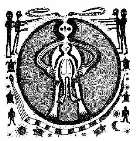
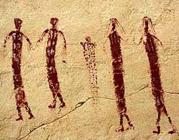
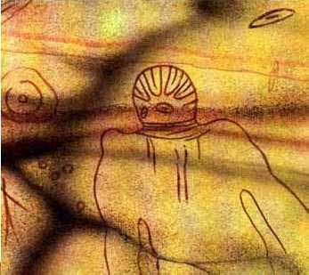
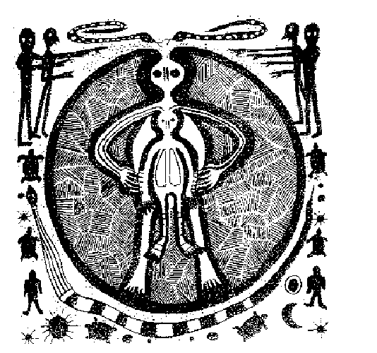
The term 'Ancient Astronauts' generally refers to extraterrestrials who
came to Earth and were in some way responsible for seeding the human race.

There are references to these entities in the bible, in ancient art and other texts. They are all linked with myths about creation found in all ancient civilizations.

As we search to find the truth behind the illusion, who created the human race, or biogenetic experiment, we look to those who came from the stars, ancient astronauts, creational gods, for our answers. All is theory, virtual reality, consciousness, and for the most part not provable, subject to the interpretation of the researcher or experiencer.

Most of us would love to find evidence of ancient astronauts, be visited by friendly aliens who could enlighten us to our true creational blueprint. Throughout the history of the human drama, we find all sorts of evidence that makes us think, believe, and quest for the greater truth. They are all just myths, legends, and theories...

Theories about Atlantis often link sightings of ancient astronauts to Atlantean space ships. This goes to the ancient gods called the Zep Tepi.

In China we find theories about an alien race called the Dropa who left behind fascinating discs.

The Popol Vuh, sacred to the Mayans, unequivocally states, "Men came from the stars, knowing everything, and they examined the four corners of the sky and the Earth's round surface."

Brazilian UFO researcher Jean Alencar has noted that the mythology of this country is replete with descriptions and statuettes of beings endowed with the power of flight. The legends of Brazilian natives, like those of other countries, detail experiences of gods or travelers from the sky who descended to earth when humans were little more that animals to instruct them in the arts of agriculture, astronomy, medicine, and other disciplines. Alencar points out one figure in particular, Bep-Kororoti, a space warrior worshipped by the tribes of the upper reaches of the Xing River. Not unlike the heroes of India's Mahabarata, Bep-Kororoti possessed a flying vehicle capable of destroying anything in its path. His aspect terrified the primitive natives, until he stepped out of his "raiment" and revealed himself to be fair-skinned, handsome, and kind. He amused the natives with his "magic" until he grew restless for his land in the sky and returned there.

The Chilam Balaam, is even more explicit and states "Beings descended from the sky in flying vessels...white men in flying rings, who can touch the sky."

There are indications that something very strange took place on our very own continent hundreds of thousands of years ago, before humans arrived on this continent (according to the canon of anthropology). Santa Maria Canyon holds evidence pointing toward the existence of a culture of intelligent beings who raised cattle, built weapons, and practiced funeral rites -- one million years ago. If we decide to stick with what academia has to say, in no way could these beings have been humans. Were they survivors of a Race of Aliens? This brings to mind theories of marooned spacemen, or colonists trying to tame a new planet? During the Prehistory Conference held during 1962 in Rome, Dr. W. Matthes presented the oldest carvings known to exist, created by a forgotten artist two hundred thousand years ago, when humans had allegedly just discovered the use of fire.

Discovered by the 19th century French explorer Henri Lhote, these figures were so unusual he dubbed them Martians, explaining their contour is simple, unartistic, and with rounded heads; their only detail is the double oval at the figure's center, which evokes the image we currently have of Martians.

Great Martian Gods c.6000 BC from Tassili Mountains


Sahara Desert


North Africa

Lhote's round-headed denizens of the Red Planet were depicted by the primitive cave artists as wearing suits strongly reminiscent of those worn by our own astronauts on the Moon, down to the detail of the boots. Several hundred such drawings exist, scattered over many miles of desert: strange helmeted and figures with antennae, often floating in weightlessness as if the artist had been able to witness one of our modern space walks. Other images are of a technological bent, showing what could be taken as solar panels, space stations, floating spheres containing humanoid figures. Unwilling to be caught up in the ancient astronaut craze, anthropologists have suggested that the Tassili "roundheads" are merely ceremonial dancers or priests wearing empty gourds over their heads. The problem with this rational approach is that the agricultural know-how and resources to grow pumpkins were nonexistent in North Africa at the time the Tassili drawings were created, and would probably not have been available for another thousand years.


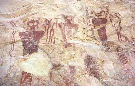
Sego Canyon, Utah, c. 5,500 BC


Val Comonica, Italy, c. 10,000 BC


The examples of cave art found in the Spanish caverns of Ojo Guarea and Altamira, and the French ones at Lascaux and Font de Gaume, have proven that our distant ancestors were able to represent what they saw with a clarity and simplicity that is stunning to twentieth century eyes. This skill extends to depictions of things that anthropologists and archaeologists often find troublesome: equally faithful representations of domed objects, some of them in threes, others with legs or antennae.

Ancient astronauts have been described as bi-pedal entities often with beaks or wings, or reptilian looking, gray aliens, ethereal, or humanoid coming and going in space craft of some kind or moving in and out of our dimension. Different theories or stories of creation cite these entities, not unlike gods from heaven who many believe seeded the human experiment and will return one day. The feeling of a god returning to Earth, a savior, if you will, who restores balance, is a metaphor in the journey of the human experiment in linear time and emotion. All virtual created by consciousness. All are theories.

The Ojo Guarea complex, weaving its way for miles into the earth, poses an undecipherable riddle. In his book En Busca de la Historia Perdida (In Search of Forgotten History), Spanish author and filmmaker Juan G. Atienza states that some of the cave systems many entrances are considered "evil," and the local farmers will not till the soil near them nor even come close to them. Contained precisely within one of these "evil" points of access is an ancient petroglyph of what could only be, astounding though it might seem, a representation of the helicoidal structure of DNA.


Source: Crystalinks

Monday, August 20, 2007

Bermuda Triangle

Sejumlah kapal laut dan pesawat terbang menghilamng begitu saja tanpa bekas. Kemana?

NASA image of the western Atlantic,
showing the popular borders of the Bermuda Triangle.

The Bermuda Triangle, also known as the Devil's Triangle, is a region of the Atlantic Ocean in which a number of aircraft and surface vessels have disappeared in what are said to be circumstances that fall beyond the boundaries of human error or acts of nature. Some of these disappearances have been attributed to the paranormal, a suspension of the laws of physics, or activity by extraterrestrial beings by popular culture. Although a substantial documentation exists showing numerous incidents to have been inaccurately reported or embellished by later authors, several others remain unexplained.

The Triangle Area

( The area of the Triangle varies by author.)

The boundaries of the Triangle vary with the author; some stating its shape is akin to a trapezium covering the Straits of Florida, the Bahamas, and the entire Caribbean island area east to the Azores; others add to it the Gulf of Mexico. The more familiar, triangular boundary in most written works has as its points Miami, Florida; San Juan, Puerto Rico; and the mid-Atlantic island of Bermuda, with most of the accidents concentrated along the southern boundary around the Bahamas and the Florida Straits.

The area is one of the most heavily-sailed shipping lanes in the world, with ships crossing through it daily for ports in the Americas and Europe, as well as the Caribbean Islands. Cruise ships are also plentiful, and pleasure craft regularly go back and forth between Florida and the islands. It is also a heavily flown route for commercial and private aircraft heading towards Florida, the Caribbean, and South America from points north.

The Gulf Stream ocean current flows through the Triangle after leaving the Gulf of Mexico; its current of five to six knots may have played a part in a number of disappearances. Sudden storms can and do appear, and in the summer to late fall the occasional hurricane strikes the area. The combination of heavy maritime traffic and tempestuous weather makes it inevitable that vessels could founder in storms and be lost without a trace — especially before improved telecommunications, radar, and satellite technology arrived late in the 20th century.

History of The Triangle Story

According to the Triangle authors, Christopher Columbus was the first person to document something strange in the Triangle, reporting that he and his crew observed "strange dancing lights on the horizon", flames in the sky, and at another point he wrote in his log about bizarre compass bearings in the area. From his log book, dated October 11, 1492 he wrote:

"The land was first seen by a sailor (Rodrigo de Triana), although the Admiral at ten o'clock that evening standing on the quarter-deck saw a light, but so small a body that he could not affirm it to be land; calling to Pero Gutiérrez, groom of the King's wardrobe, he told him he saw a light, and bid him look that way, which he did and saw it; he did the same to Rodrigo Sánchez of Segovia, whom the King and Queen had sent with the squadron as comptroller, but he was unable to see it from his situation. The Admiral again perceived it once or twice, appearing like the light of a wax candle moving up and down, which some thought an indication of land. But the Admiral held it for certain that land was near..."

Modern scholars checking the original log books have surmised that the lights he saw were the cooking fires of Taino natives in their canoes or on the beach; the compass problems were the result of a false reading based on the movement of a star. The flames in the sky were undoubtedly falling meteors, which are easily seen while at sea.

The first article of any kind in which the legend of the Triangle began appeared in newspapers by E.V.W. Jones on September 16, 1950, through the Associated Press. Two years later, Fate magazine published "Sea Mystery At Our Back Door", a short article by George X. Sand in the October 1952 issue covering the loss of several planes and ships, including the loss of Flight 19, a group of five U.S. Navy TBM Avenger bombers on a training mission. Sand's article was the first to lay out the now-familiar triangular area where the losses took place. Flight 19 alone would be covered in the April 1962 issue of American Legion Magazine. The article was titled "The Lost Patrol", by Allen W. Eckert, and in his story it was claimed that the flight leader had been heard saying "We are entering white water, nothing seems right. We don't know where we are, the water is green, no white." It was also claimed that officials at the Navy board of inquiry stated that the planes "flew off to Mars." "The Lost Patrol" was the first to connect the supernatural to Flight 19, but it would take another author, Vincent Gaddis, writing in the February 1964 Argosy Magazine to take Flight 19 together with other mysterious disappearances and place it under the umbrella of a new catchy name: "The Deadly Bermuda Triangle"; he would build on that article with a more detailed book, Invisible Horizons, the next year. Others would follow with their own works: John Wallace Spencer (Limbo of the Lost, 1969); Charles Berlitz (The Bermuda Triangle, 1974); Richard Winer (The Devil's Triangle, 1974), and many others, all keeping to some of the same supernatural elements outlined by Eckert.

Kusche's Explanation

Lawrence David Kusche, a research librarian from Arizona State University and author of The Bermuda Triangle Mystery: Solved (1975) has challenged this trend. Kusche's research revealed a number of inaccuracies and inconsistencies between Berlitz's accounts and statements from eyewitnesses, participants, and others involved in the initial incidents. He noted cases where pertinent information went unreported, such as the disappearance of round-the-world yachtsman Donald Crowhurst, which Berlitz had presented as a mystery, despite clear evidence to the contrary. Another example was the ore-carrier Berlitz recounted as lost without trace three days out of an Atlantic port when it had been lost three days out of a port with the same name in the Pacific Ocean. Kusche also argued that a large percentage of the incidents which have sparked the Triangle's mysterious influence actually occurred well outside it. Often his research was surprisingly simple: he would go over period newspapers and see items like weather reports that were never mentioned in the stories.

Kusche came to several conclusions:

  • The number of ships and aircraft reported missing in the area was not significantly greater, proportionally speaking, than in any other part of the ocean.
  • In an area frequented by tropical storms, the number of disappearances that did occur were, for the most part, neither disproportionate, unlikely, nor mysterious; furthermore, Berlitz and other writers would often fail to mention such storms.
  • The numbers themselves had been exaggerated by sloppy research. A boat listed as missing would be reported, but its eventual (if belated) return to port may not be reported.
  • Some disappearances had in fact, never happened. One plane crash was said to have taken place in 1937 off Daytona Beach, Florida, in front of hundreds of witnesses; a check of the local papers revealed nothing.

Kusche concluded that:

"The Legend of the Bermuda Triangle is a manufactured mystery... perpetuated by writers who either purposely or unknowingly made use of misconceptions, faulty reasoning, and sensationalism." (Epilogue, p. 277)

In recent years, however, several authors, most notably Gian J. Quasar, have raised several questions as to the veracity of Kusche's findings, including, but not limited to, why Kusche so often brought up as evidence for his claims cases that were already well-known before the writing of his work as not being Triangle incidents; his misidentification and mislocation of several ship and aircraft incidents that are well-documented, but then using that inability to properly identify the craft as "proof" that they never existed; and in other examples openly claiming possibilities for foul weather for certain disappearances where it can be verified that none existed.

Other Responses

The marine insurer Lloyd's of London has determined the Triangle to be no more dangerous than any other area of ocean, and does not charge unusual rates for passage through the region. United States Coast Guard records confirm their conclusion. In fact, the number of supposed disappearances is relatively insignificant considering the number of ships and aircraft which pass through on a regular basis.

The Coast Guard is also officially skeptical of the Triangle, noting that they collect and publish, through their inquiries, much documentation contradicting many of the incidents written about by the Triangle authors. In one such incident involving the 1972 explosion and sinking of the tanker V.A. Fogg in the Gulf of Mexico, the Coast Guard photographed the wreck and recovered several bodies despite one Triangle author stating that all the bodies had vanished, with the exception of the captain, who was found sitting in his cabin at his desk, clutching a coffee cup (Limbo of the Lost by John Wallace Spencer, 1973 edition).

Skeptical researchers, such as Ernest Taves and Barry Singer, have noted how mysteries and the paranormal are very popular and profitable. This has led to the production of vast amounts of material on topics such as the Bermuda Triangle. They were able to show that some of the pro-paranormal material is often misleading or not accurate, but its producers continue to market it. They have therefore claimed that the market is biased in favour of books, TV specials, etc. which support the Triangle mystery and against well-researched material if it espouses a skeptical viewpoint.

Natural Explanation

Methane Hydrate

Main article: Methane clathrate

Worldwide distribution of confirmed or inferred offshore gas hydrate-bearing sediments, 1996.Source: USGS

Worldwide distribution of confirmed or inferred offshore gas hydrate-bearing sediments, 1996.
Source: USGS

False-color image of the Gulf Stream flowing north through the western Atlantic Ocean. (NASA)

False-color image of the Gulf Stream flowing north through the western Atlantic Ocean. (NASA)

USS Memphis in 1916, hard aground in the Dominican Republic after an encounter with a freak wave. (U.S. Navy)

USS Memphis in 1916, hard aground in the Dominican Republic after an encounter with a freak wave. (U.S. Navy)

An explanation for some of the disappearances has focused on the presence of vast fields of methane hydrates on the continental shelves. Laboratory experiments carried out in Australia have proven that bubbles can, indeed, sink a scale model ship by decreasing the density of the water; any wreckage consequently rising to the surface would be rapidly dispersed by the Gulf Stream. It has been hypothesized that periodic methane eruptions (sometimes called "mud volcanoes") may produce regions of frothy water that are no longer capable of providing adequate buoyancy for ships. If this were the case, such an area forming around a ship could cause it to sink very rapidly and without warning.

Airplanes may also be susceptible to any freak methane releases. Methane also has the ability to cause a piston engine to stall when released into the atmosphere, even at an atmospheric concentration as low as 1%[citation needed]. But although methane is lighter than air, the altimeter of an airplane traveling through it would not, contrary to popular belief, read that the airplane is higher than it really is, causing navigational problems. (Altimeters measure pressure, not the density of air.)

A white paper was published in 1981 by the United States Geological Survey about the appearance of hydrates in the Blake Ridge area, off the southeastern United States coast.[11] However, according to a USGS web page, no large releases of gas hydrates are believed to have occurred in the Bermuda Triangle for the past 15,000 years.

Compass Variations

Compass problems are one of the cited phrases in many Triangle incidents. The North Magnetic Pole is not the North Pole; rather it is the north end of the earth's magnetic field. The North Magnetic Pole does wander, but so slowly that the wandering would not be noticeable on time scale of a sea or air voyage. In general, the compass does not point exactly the direction of the North Magnetic Pole, but rather the compass needle aligns itself to the local geomagnetic field, which can vary in a complex manner over the Earth's surface, as well as over time.

The angular difference between magnetic north and true north (defined in reference to the Geographic North Pole), at any particular location on the Earth's surface, is called the magnetic declination. Most map coordinate systems are based on true north, and magnetic declination is often shown on map legends so that the direction of true north can be determined from north as indicated by a compass. The line of zero declination in the U.S. runs from the North Magnetic Pole through Lake Superior and across the western panhandle of Florida. Along this line, true north is the same as magnetic north. West of the line of zero declination, a compass will give a reading that is east of true north. Conversely, east of the line of zero declination, a compass reading will be west of true north. Since the North Magnetic Pole has been slowly migrating toward the northwest, some twenty or more years ago the line of zero declination went through the Triangle, giving sailors and airmen a compass reading of true north instead of magnetic north. A sailor not knowing the difference could inadvertently sail off course.

Some have theorized the possibility of unusual local magnetic anomalies in the area, however these have not been shown to exist.

Hurricanes

Hurricanes are extremely powerful storms which are spawned in the Atlantic near the equator, and have historically been responsible for thousands of lives lost and billions of dollars in damage. The sinking of Francisco de Bobadilla's Spanish fleet in 1502 was the first recorded instance of a destructive hurricane. In 1988, Hurricane Gilbert, one of the most powerful hurricanes in history, set back Jamaica's economy by three years. These storms have in the past caused a number of incidents related to the Triangle.

Gulf Stream

The Gulf Stream is an ocean current that originates in the Gulf of Mexico, and then through the Straits of Florida, into the North Atlantic. In essence, it is a river within an ocean, and like a river, it can and does carry floating objects. A small plane making a water landing or a boat having engine trouble will be carried away from its reported position by the current, as happened to the cabin cruiser Witchcraft on December 22, 1967, when it reported engine trouble near the Miami buoy marker one mile from shore, but was not there when a Coast Guard cutter arrived.

Freak Waves
Main article: Rogue wave (oceanography)
Extremely large waves can appear seemingly at random, even in calm seas. One such rogue wave wrecked the cruiser USS Memphis off the Dominican Republic on August 29, 1916, killing 40 men. There is, however, no particular reason to believe rogue waves are more common in the Bermuda region, and this could not explain loss of airplanes.

Acts Of Man

Human error

One of the most cited explanations in official inquiries as to the loss of any aircraft or vessel is human error. Whether deliberate or accidental, humans have been known to make mistakes resulting in catastrophe, and losses within the Bermuda Triangle are no exception. For example, the Coast Guard cited a lack of proper training for the cleaning of volatile benzene residue as a reason for the loss of the tanker V.A. Fogg in 1972. Human stubbornness may have caused businessman Harvey Conover to lose his sailing yacht, the Revonoc, as he sailed into the teeth of a storm south of Florida on January 1, 1958. It should be noted that many losses remain inconclusive due to the lack of wreckage which could be studied, a fact cited on many official reports.

Deliberate acts of destruction

This can fall into two categories: acts of war, and acts of piracy. Records in enemy files have been checked for numerous losses; while many sinkings have been attributed to surface raiders or submarines during the World Wars and documented in the various command log books, many others which have been suspected as falling in that category have not been proven; it is suspected that the loss of USS Cyclops in 1918, as well as her sister ships Proteus and Nereus in World War II, were attributed to submarines, but no such link has been found in the German records.

Piracy, as defined by the taking of a ship or small boat on the high seas, is an act which continues to this day. While piracy for cargo theft is more common in the western Pacific and Indian oceans, drug smugglers do steal pleasure boats for smuggling operations, and may have been involved in crew and yacht disappearances in the Caribbean. Historically famous pirates of the Caribbean (where piracy was common from about 1560 to the 1760s) include Edward Teach (Blackbeard) and Jean Lafitte. Lafitte is sometimes said to be a Triangle victim himself.

Another form of pirate operated on dry land. Bankers or wreckers would shine a light on shore to misdirect ships, which would then founder on the shore; the wreckers would then help themselves to the cargo. It is possible that these wreckers also killed any crew who protested. Nags Head, North Carolina, was named for the wreckers' practice of hanging a lantern on the head of a hobbled horse as it walked along the beach.

Popular Theories

The following theories have been used in the past by the Triangle writers to explain a myriad of incidents:

Atlantis

An explanation for some of the disappearances pinned the blame on left-over technology from Atlantis. Reputed psychic Edgar Cayce claimed that evidence for Atlantis would be discovered just off Bimini in 1968. New Agers view the Bimini Road as either a road, wall, or pier meant to service ships bound for Atlantis from Central and South America, or a breakwater built to protect fishing boats. The wall may also have a natural origin.[14][15][16]

UFOs

Some theorists claim extraterrestrials are the reason of disappearances by abducting ships and aircraft. [citation needed] This was given a boost when topics like ESP, telekinesis, clairvoyance, and the like flowered in the middle-to-late 1960s, and was used as storylines for popular films like Close Encounters of the Third Kind and The UFO Incident.

Time Warp

The proponents of this theory state that the many ships and planes entered a time warp to a different time or dimension on the other side, meaning that their crews could still be alive there, living new lives in another time period of the past or the future – or even possibly in a parallel universe. [citation needed] Usually, the ship or aircraft in the story enters this dimension by way of a cloud. This has been a popular subject in science fiction.

Anomalous Phenomena

Charles Berlitz, grandson of a distinguished linguist and author of various additional books on anomalous phenomena, has kept in line with this extraordinary explanation, and attributed the losses in the Triangle to anomalous or unexplained forces.

Famous Incidents

Flight 19

US Navy TBF Grumman Avenger flight, similar to Flight 19.  This photo had been used by various Triangle authors to illustrate Flight 19 itself. (US Navy)

US Navy TBF Grumman Avenger flight, similar to Flight 19. This photo had been used by various Triangle authors to illustrate Flight 19 itself. (US Navy)

Flight 19 was a training flight of TBM Avenger bombers that went missing on December 5, 1945 while over the Atlantic. The impression is given that the flight encountered unusual phenomena and anomalous compass readings, and that the flight took place on a calm day under the leadership of an experienced pilot, Lt. Charles Carroll Taylor. Adding to the intrigue is that the Navy's report of the accident was ascribed to "causes or reasons unknown." It is believed that Charles Taylor's mother wanted to save Charles's reputation, so she made them write "reasons unknown" when actually Charles was 50 km NW from where he thought he was.

While the basic facts of this version of the story are essentially accurate, some important details are missing. The weather was becoming stormy by the end of the incident; only Lt. Taylor had any significant flying time, but he was not familiar with the south Florida area and had a history of getting lost in flight, having done so three times during World War II, and being forced to ditch his planes twice into the water; and naval reports and written recordings of the conversations between Lt. Taylor and the other pilots of Flight 19 do not indicate magnetic problems.

Mary Celeste

The mysterious abandonment in 1872 of the Mary Celeste is often but inaccurately connected to the Triangle, the ship having been abandoned off the coast of Portugal. Many theories have been put forth over the years to explain the abandonment, including alcohol fumes from the cargo and insurance fraud. The event is possibly confused with the sinking of a ship with a similar name, the Mari Celeste, off the coast of Bermuda on September 13, 1864, which is mentioned in the book Bermuda Shipwrecks by Dan Berg.

Ellen Austin

The Ellen Austin supposedly came across an abandoned derelict, placed on board a prize crew, and attempted to sail with it to New York in 1881. According to the stories, the derelict disappeared; others elaborating further that the derelict reappeared minus the prize crew, then disappeared again with a second prize crew on board. A check of Lloyd's of London records proved the existence of the Meta, built in 1854; in 1880 the Meta was renamed Ellen Austin. There are no casualty listings for this vessel, or any vessel at that time, that would suggest a large number of missing men placed on board a derelict which later disappeared.

Teignmouth Electron

Teignmouth Electron, as she was on July 10, 1969.

Teignmouth Electron, as she was on July 10, 1969.

Donald Crowhurst was a sailor competing in the Sunday Times Golden Globe Race of 1968-69. His boat, a trimaran named Teignmouth Electron, left England on October 31, 1968; it was found abandoned south of the Azores on July 10, 1969. Most writers on the Triangle would stop there (only Winer elaborated on the facts), leaving out the evidence recovered from Crowhurst's logbooks which showed deception as to his position in the race and increasing irrationality. His last entry was June 29; it was assumed he jumped over the side a short time later.

USS Cyclops

The incident resulting in the single largest loss of life in the history of the U.S. Navy not related to combat occurred when USS Cyclops under the command of Lieutenant Commander G. W. Worley, went missing without a trace with a crew of 306 sometime after March 4, 1918, after departing the island of Barbados. Although there is no strong evidence for any theory, storms, capsizing and enemy activity have all been suggested as explanations.

Theodosia Burr Alston

Theodosia Burr Alston was the daughter of former United States Vice-President Aaron Burr. Her disappearance has been cited at least once in relation to the Triangle, in The Bermuda Triangle by Adi-Kent Thomas Jeffrey (1975). She was a passenger on board the Patriot, which sailed from Charleston, South Carolina to New York City on December 30, 1812, and was never heard from again. Both Piracy and the War of 1812 have been posited as explanations, as well as a theory placing her in Texas, well outside the Triangle.

The Spray

Captain Joshua Slocum's skill as a mariner was beyond argument; he was the first man to sail around the world solo. In 1909, in his boat Spray he set out in a course to take him through the Caribbean to Venezuela. He disappeared; there was no evidence he was even in the Triangle when Spray was lost. It was assumed he was run down by a steamer or struck by a whale, the Spray being too sound a craft and Slocum too experienced a mariner for any other cause to be considered likely, and in 1924 he was declared legally dead. While a mystery, there is no known evidence for, or against, paranormal activity.

Carrol A. Deering

Schooner Carroll A. Deering, as seen from the Cape Lookout lightship on January 29, 1921, two days before she was found deserted in North Carolina. (US Coast Guard)

Schooner Carroll A. Deering, as seen from the Cape Lookout lightship on January 29, 1921, two days before she was found deserted in North Carolina. (US Coast Guard)

A five-masted schooner built in 1919, the Carroll A. Deering was found hard aground and abandoned at Diamond Shoals, near Cape Hatteras, North Carolina on January 31, 1921. Rumors and more at the time indicated the Deering was a victim of piracy, possibly connected with the illegal rum-running trade during Prohibition, and possibly involving another ship, S.S. Hewitt, which disappeared at roughly the same time. Just hours later, an unknown steamer sailed near the lightship along the track of the Deering, and ignored all signals from the lightship. It is speculated that the Hewitt may have been this mystery ship, and possibly involved in the Deering crew's disappearance.

Douglas DC-3

On December 28, 1948, a Douglas DC-3 aircraft, number NC16002, disappeared while on a flight from San Juan, Puerto Rico, to Miami. No trace of the aircraft or the 32 people onboard was ever found. From the documentation compiled by the Civil Aeronautics Board investigation, a possible key to the plane's disappearance was found, but barely touched upon by the Triangle writers: the plane's batteries were inspected and found to be low on charge, but ordered back into the plane without a recharge by the pilot while in San Juan. Whether or not this led to complete electrical failure will never be known. However, since piston-engined aircraft rely upon magnetos to provide electrical power and spark to their cylinders rather than batteries, this theory is unlikely.

Star Tiger and Star Ariel

These Avro Tudor IV passenger aircraft disappeared without trace en route to Bermuda and Jamaica, respectively. Star Tiger was lost on January 30, 1948 on a flight from the Azores to Bermuda. Star Ariel was lost on January 17, 1949, on a flight from Bermuda to Kingston, Jamaica. Neither aircraft gave out a distress call; in fact, their last messages were routine. A possible clue to their disappearance was found in the mountains of the Andes in 1998: the Star Dust, an Avro Lancastrian airliner run by the same airline, had disappeared on a flight from Buenos Aires, Argentina, to Santiago, Chile on August 2, 1947. The plane's remains were discovered at the melt end of a glacier, suggesting that either the crew did not pay attention to their instruments, suffered an instrument failure or did not allow for headwind effects from the jetstream on the way to Santiago when it hit a mountain peak, with the resulting avalanche burying the remains and incorporating it into the glacier. However, this is mere speculation with regard to the Star Tiger and Star Ariel, pending the recovery of the aircraft. It should be noted that the Star Tiger was flying at a height of just 2,000 feet, which would have meant that if the plane was forced down, there would have been no time to send out a distress message. It is also far too low for the jetstream or any other high-altitude wind to have any effect.

KC-135 Stratotankers

On August 28, 1963 a pair of U.S. Air Force KC-135 Stratotanker aircraft collided and crashed into the Atlantic. The Triangle version (Winer, Berlitz, Gaddis) of this story specifies that they did collide and crash, but there were two distinct crash sites, separated by over 160 miles of water. However, Kusche's research showed that the unclassified version of the Air Force investigation report stated that the debris field defining the second "crash site" was examined by a search and rescue ship, and found to be a mass of seaweed and driftwood tangled in an old buoy.

SS Marine Sulphur Queen


SS Marine Sulphur Queen, a T2 tanker converted from oil to sulfur carrier, was last heard from on February 4, 1963 with a crew of 39 near the Florida Keys. Marine Sulphur Queen was the first vessel mentioned in Vincent Gaddis' 1964 Argosy Magazine article, but he left it as having "sailed into the unknown", despite the Coast Guard report which not only documented the ship's badly-maintained history, but declared that it was an unseaworthy vessel that should never have gone to sea.

USS Scorpion

The nuclear-powered submarine USS Scorpion was lost south of the Azores while on a transit home to Norfolk, Virginia after a six-month deployment on May 26, 1968. The Scorpion had been picked up by numerous writers (Berlitz, Spencer, Thomas-Jeffery) as a Triangle victim over the years, despite the fact that it did not sink in the Bermuda Triangle; the U.S. Navy believes that a malfunctioning torpedo contributed to her loss, an event actually recorded on the SOSUS microphone network.

Raifuku Maru

One of the more famous incidents in the Triangle took place in 1921 (some say a few years later), when the Japanese vessel Raifuku Maru (sometimes misidentified as Raikuke Maru) went down with all hands after sending a distress signal which allegedly said "Danger like dagger now. Come quick!", or "It's like a dagger, come quick!" This has led writers to speculate on what the "dagger" was, with a waterspout being the likely candidate (Winer). In reality the ship was nowhere near the Triangle, nor was the word "dagger" a part of the ship's distress call ("Now very danger. Come quick."); having left Boston for Hamburg, Germany, on April 21, 1925, she got caught in a severe storm and sank in the North Atlantic with all hands while another ship, RMS Homeric, attempted an unsuccessful rescue.

Connemara IV

A pleasure yacht found adrift in the Atlantic south of Bermuda on September 26, 1955; it is usually stated in the stories (Berlitz, Winer) that the crew vanished while the yacht survived being at sea during three hurricanes. The 1955 Atlantic hurricane season lists only one storm coming near Bermuda towards the end of August, hurricane "Edith"; of the others, "Flora" was too far to the east, and "Katie" arrived after the yacht was recovered. It was confirmed that the Connemara IV was empty and in port when "Edith" may have caused the yacht to slip her moorings and drift out to sea.

Sources : Wikipedia

Friday, August 17, 2007

Atlantis

Benarkah dahulu kala ada sebuah benua yang masyarakatnya memiliki tingkat peradaban yang luar biasa maju dan kemudian tenggelam di telan lautan?

Picture of Plato's description of Atlantis

Atlantis (Greek: Ἀτλαντὶς νῆσος, "Island of Atlas") is the name of a legendary island first mentioned in Plato's dialogues Timaeus and Critias.

In Plato's account, Atlantis, lying "beyond the pillars of Heracles", was a naval power that conquered many parts of Western Europe and Africa, over 9,000 years before Plato's own time — approximately 9400 BC. After a failed attempt to invade Athens, Atlantis sank into the ocean "in a single day and night of misfortune".

As a story embedded in Plato's dialogues, Atlantis is generally seen as a myth created by Plato to illustrate his political theories. Although the function of the story of Atlantis seems clear to most scholars, they dispute whether and how much Plato's account was inspired by older traditions. Some scholars argue Plato drew upon memories of past events such as the Thera eruption or the Trojan War, while others insist that he took inspiration of contemporary events like the destruction of Helike in 373 BC or the failed Athenian invasion of Sicily in 415–413 BC.

The possible existence of a genuine Atlantis was actively discussed throughout the classical antiquity, but it was usually rejected and occasionally parodied. While basically unknown during the Middle Ages, the story of Atlantis was rediscovered by Humanists at the very beginning of modern times. Plato's description inspired the utopian works of several Renaissance writers, like Francis Bacon's "New Atlantis". To this day, Atlantis inspires today's literature, from science fiction to comic books and movies, its name having become a byword for any and all supposed prehistoric but advanced (and lost) civilizations.

Plato's Account

These works, written in the year 360 BC, contain the earliest known references to Atlantis. For unknown reasons, Plato never completed the dialogue Critias; however, the scholar Benjamin Jowett, among others, argues that Plato originally planned a third dialogue titled Hermocrates. John V. Luce assumes that Plato — after describing the origin of the world and mankind in Timaeus as well as the allegorical perfect society of ancient Athens and its successful defense against an antagonistic Atlantis in Critias — would have made the strategy of the Hellenic civilisation during their conflict with the barbarians a subject of discussion in the Hermocrates. Plato introduced Atlantis in Timaeus:

Many great and wonderful deeds are recorded of your state in our histories. But one of them exceeds all the rest in greatness and valour. For these histories tell of a mighty power which unprovoked made an expedition against the whole of Europe and Asia, and to which your city put an end. This power came forth out of the Atlantic Ocean, for in those days the Atlantic was navigable; and there was an island situated in front of the straits which are by you called the Pillars of Heracles; the island was larger than Libya and Asia put together, and was the way to other islands, and from these you might pass to the whole of the opposite continent which surrounded the true ocean; for this sea which is within the Straits of Heracles is only a harbour, having a narrow entrance, but that other is a real sea, and the surrounding land may be most truly called a boundless continent. Now in this island of Atlantis there was a great and wonderful empire... (from Timaeus)

The four persons appearing in those two dialogues are the politicians Critias and Hermocrates as well as the philosophers Socrates and Timaeus, although only Critias speaks of Atlantis. While most likely all of these people actually lived, these dialogues as recorded may have been the invention of Plato. In his written works, Plato makes extensive use of the Socratic dialogues in order to discuss contrary positions within the context of a supposition.

The Timaeus begins with an introduction, followed by an account of the creations and structure of the universe and ancient civilizations. In the introduction, Socrates muses about the perfect society, described in Plato's Republic, and wonders if he and his guests might recollect a story which exemplifies such a society. Critias mentions an allegedly historical tale that would make the perfect example, and follows by describing Atlantis as is recorded in the Critias. In his account, ancient Athens seems to represent the "perfect society" and Atlantis its opponent, representing the very antithesis of the "perfect" traits described in the Republic. Critias claims that his accounts of ancient Athens and Atlantis stem from a visit to Egypt by the Athenian lawgiver Solon in the 6th century BC. In Egypt, Solon met a priest of Sais, who translated the history of ancient Athens and Atlantis, recorded on papyri in Egyptian hieroglyphs, into Greek. According to Plutarch the priest was named Sonchis, but because of the temporal distance between Plutarch and the alleged event, this identification is unverified.

According to Critias, the Hellenic gods of old divided the land so that each god might own a lot; Poseidon was appropriately, and to his liking, bequeathed the island of Atlantis. The island was larger than Libya and Asia Minor combined, but it afterwards was sunk by an earthquake and became an impassable mud shoal, inhibiting travel to any part of the ocean. The Egyptians described Atlantis as an island approximately 700 kilometres (435 mi) across, comprising mostly mountains in the northern portions and along the shore, and encompassing a great plain of an oblong shape in the south "extending in one direction three thousand stadia [about 600 km; 375 mi], but across the center inland it was two thousand stadia [about 400 km; 250 mi]."

Fifty stadia inland from the coast was a "mountain not very high on any side." Here lived a native woman with whom Poseidon fell in love and who bore him five pairs of male twins. The eldest of these, Atlas, was made rightful king of the entire island and the ocean (called the Atlantic Ocean in honor of Atlas), and was given the mountain of his birth and the surrounding area as his fiefdom. Atlas's twin Gadeirus or Eumelus in Greek, was given the extremity of the island towards the Pillars of Heracles. The other four pairs of twins — Ampheres and Evaemon, Mneseus and Autochthon, Elasippus and Mestor, and Azaes and Diaprepes — were also given "rule over many men, and a large territory."

Poseidon carved the inland mountain where his love dwelt into a palace and enclosed it with three circular moats of increasing width, varying from one to three stadia and separated by rings of land proportional in size. The Atlanteans then built bridges northward from the mountain, making a route to the rest of the island. They dug a great canal to the sea, and alongside the bridges carved tunnels into the rings of rock so that ships could pass into the city around the mountain; they carved docks from the rock walls of the moats. Every passage to the city was guarded by gates and towers, and a wall surrounded each of the city's rings. The walls were constructed of red, white and black rock quarried from the moats, and were covered with brass, tin and orichalcum, respectively.

According to Critias, 9,000 years before his lifetime a war took place between those outside the Pillars of Hercules (generally thought to be the Strait of Gibraltar) and those who dwelt within them. The Atlanteans had conquered the parts of Libya within the columns of Heracles as far as Egypt and the European continent as far as Tyrrhenia, and subjected its people to slavery. The Athenians led an alliance of resistors against the Atlantean empire and as the alliance disintegrated, prevailed alone against the empire, liberating the occupied lands. "But later there occurred violent earthquakes and floods; and in a single day and night of misfortune all your warlike men in a body sank into the earth, and the island of Atlantis in like manner disappeared in the depths of the sea."

Ancient Reception

Other than Plato's Timaeus and Critias there is no primary ancient account of Atlantis, which means every other account on Atlantis relies on Plato in one way or another. To this day, no proof for a non-Platonic tradition of Atlantis has been found. However, the Greek logographer Hellanicus of Lesbos wrote a work (now lost), named Atlantis (or Atlantias), about the daughter of the titan Atlas (not the Atlas mentioned by Plato). However, it is unlikely that this work was an inspiration to Plato, since he named Atlantis after the Atlantic Ocean (ancient Greek: τλαντς θάλασσα, "Sea of Atlas"), which already had this name in the time of Herodotus.

Many ancient philosophers viewed Atlantis as fiction, including (according to Strabo), Aristotle. However, in antiquity, there were also philosophers, geographers, and historians who believed that Atlantis was real. For instance, the philosopher Crantor, a student of Plato's student Xenocrates, tried to find proof of Atlantis' existence. His work, a commentary on Plato's Timaeus, is lost, but another ancient historian, Proclus, reports that Crantor traveled to Egypt and actually found columns with the history of Atlantis written in hieroglyphic characters. However, Plato did not write that Solon saw the Atlantis story on a column but on a source that can be "taken to hand". Proclus' proof appears implausible.

Another passage from Proclus' 5th century AD commentary on the Timaeus gives a description of the geography of Atlantis: "That an island of such nature and size once existed is evident from what is said by certain authors who investigated the things around the outer sea. For according to them, there were seven islands in that sea in their time, sacred to Persephone, and also three others of enormous size, one of which was sacred to Pluto, another to Ammon, and another one between them to Poseidon, the extent of which was a thousand stadia; and the inhabitants of it—they add—preserved the remembrance from their ancestors of the immeasurably large island of Atlantis which had really existed there and which for many ages had reigned over all islands in the Atlantic sea and which itself had like-wise been sacred to Poseidon. Now these things Marcellus has written in his Aethiopica". However, Heinz-Günther Nesselrath argues that this Marcellus — who is otherwise unknown — is probably not a historian but a novelist.

Other ancient historians and philosophers believing in the existence of Atlantis were Strabo and Posidonius (cf. Strabo 2,3,6).

Plato's account of Atlantis may have also inspired parodic imitation: writing only a few decades after the Timaeus and Critias, the historian Theopompus of Chios wrote of a land beyond the ocean known as Meropis. This description was included in Book 8 of his voluminous Philippica, which contains a dialogue between King Midas and Silenus, a companion of Dionysus. Silenus describes the Meropids, a race of men who grow to twice normal size, and inhabit two cities on the island of Meropis: Eusebes (Εσεβής, "Pious-town") and Machimos (Μάχιμος, "Fighting-town"). He also reports that an army of ten million soldiers crossed the ocean to conquer Hyperborea, but abandoned this proposal when they realized that the Hyperboreans were the luckiest people on earth. Heinz-Günther Nesselrath has argued that these and other details of Silenus' story are meant as imitation and exaggeration of the Atlantis story, for the purpose of exposing Plato's ideas to ridicule.

Somewhat similar is the story of Panchaea, written by philosopher Euhemerus. It mentions a perfect society on an island in the Indian Ocean. Zoticus, a Neoplatonist philosopher of the 3rd century AD, wrote an epic poem based on Plato's account of Atlantis.

The 4th century AD historian Ammianus Marcellinus, relying on a lost work by Timagenes, a historian writing in the 1st century BC, writes that the Druids of Gaul said that part of the inhabitants of Gaul had migrated there from distant islands. Ammianus' testimony has been understood by some as a claim that when Atlantis sunk into the sea, its inhabitants fled to western Europe; but Ammianus in fact says that “the Drasidae (Druids) recall that a part of the population is indigenous but others also migrated in from islands and lands beyond the Rhine" (Res Gestae 15.9), an indication that the immigrants came to Gaul from the north and east, not from the Atlantic Ocean.

Modern Reception

Francis Bacon's 1627 novel The New Atlantisdescribes a utopian society, called Bensalem, located off the western coast of America. A character in the novel gives a history of Atlantis that is similar to Plato's, and places Atlantis in America. It is not clear whether Bacon means North or South America.

In middle and late 19th century, several renowned Mesoamerican scholars, starting with Charles Etienne Brasseur de Bourbourg, and including Edward Herbert Thompson and Augustus Le Plongeon proposed that Atlantis was somehow related to Mayan and Aztec culture.

Ignatius L. Donnelly, American congressman, and writer on Atlantis.

American psychic Edgar Cayce, 1910

The 1882 publication of Atlantis: the Antediluvian World by Ignatius L. Donnelly stimulated much popular interest in Atlantis. Donnelly took Plato's account of Atlantis seriously and attempted to establish that all known ancient civilizations were descended from its high Neolithic culture.

During the late 19th century, ideas about the legendary nature of Atlantis were combined with stories of other lost continents such as Mu and Lemuria by popular figures in the occult and the growing new age phenomenon. Helena Blavatsky, the "Grandmother of the New Age movement," writes in The Secret Doctrine that the Atlanteans were cultural heroes (contrary to Plato who describes them mainly as a military threat), and are the fourth "Root Race", succeeded by the "Aryan race". Rudolf Steiner wrote of the cultural evolution of Mu or Atlantis. Famed psychic Edgar Cayce first mentioned Atlantis in a life reading given in 1923, and later gave its geographical location as the Caribbean, and proposed that Atlantis was an ancient, now-submerged, highly-evolved civilization which had ships and aircraft powered by a mysterious form of energy crystal. He also predicted that parts of Atlantis would rise in 1968 or 1969. The Bimini Road, found by Dr.J Manson Valentine, was a submarine geological formation just off North Bimini Island, discovered in 1968, has been claimed by some to be evidence of the lost civilization (among many other things) and is still being explored today.

Before the time of Eratosthenes about 250 BC, Greek writers located the Pillars of Hercules on the Strait of Sicily. This changed with Alexander the Great’s eastward expansion and the Pillars were moved by Eratosthenes to Gibraltar. This evidence has been cited in some Atlantis theories, notably in Sergio Frau's work. His theory, supported by scholars and archaeologists, is still studied by the UNESCO.

Nationalist and Socialist ideas

Plato's Atlantis has been considered by some socialists as an early socialist utopia. British nationalists identified the British isles with Atlantis.

The concept of Atlantis also attracted National Socialist (Nazi) theorists. In 1938, Heinrich Himmler organized a search in Tibet to find a remnant of the white Atlanteans. According to Julius Evola (Revolt Against the Modern World, 1934), the Atlanteans were Hyperboreans—Nordic supermen who originated on the North pole (see Thule). Similarly, Alfred Rosenberg (The Myth of the Twentieth Century, 1930) spoke of a "Nordic-Atlantean" or "Aryan-Nordic" master race.

Recent times

As continental drift became more widely accepted during the 1960s, most “Lost Continent” theories of Atlantis began to wane in popularity. In response, some recent theories propose that elements of Plato's story were derived from earlier myths.

Plato scholar Dr Julia Annas (Regents Professor of Philosophy, University of Arizona) has had this to say on the matter:

The continuing industry of discovering Atlantis illustrates the dangers of reading Plato. For he is clearly using what has become a standard device of fiction — stressing the historicity of an event (and the discovery of hitherto unknown authorities) as an indication that what follows is fiction. The idea is that we should use the story to examine our ideas of government and power. We have missed the point if instead of thinking about these issues we go off exploring the sea bed. The continuing misunderstanding of Plato as historian here enables us to see why his distrust of imaginative writing is sometimes justified.
Location

Inside The Mediterranean

Since Donnelly's day, there have been dozens – perhaps hundreds – of locations proposed for Atlantis, to the point where the name has become a generic term rather than referring to one specific (possibly even genuine) location. This is reflected in the fact that many proposed sites are not within the Atlantic at all. Some are scholarly or archaeological hypotheses, while others have been made by psychic or other pseudoscientific means. Many of the proposed sites share some of the characteristics of the Atlantis story (water, catastrophic end, relevant time period), but none has been proven conclusively to be a true historical Atlantis. Most of the historically proposed locations are in or near the Mediterranean Sea, either islands such as Sardinia, Crete and Santorini, Cyprus, Malta, and Ponza or as land-based cities or states such as Troy, Tartessos or Tantalus (in the province of Manisa), Turkey, and the new theory of Israel-Sinai or Canaan as possible locations. The massive Thera eruption, dated either to the 17th or the 15th century BCE, caused a massive tsunami that experts hypothesise devastated the Minoan civilization on the nearby island of Crete, further leading some to believe that this may have been the catastrophe that inspired the story.[15]

A. G. Galanopoulos argued that the time scale has been distorted by an error in translation, probably from Egyptian into Greek, which produced "thousands" instead of "hundreds"; this same error would rescale Plato's Kingdom of Atlantis to the size of Crete, while leaving the city the size of the crater on Thera. 900 years before Solon would be the 15th century BCE. [16]

Outside The Mediterranean

Locations as wide-ranging as Andalusia, Antarctica, Indonesia, underneath the Bermuda Triangle[17], and the Caribbean have been proposed as the true site of Atlantis. In the area of the Black Sea the following locations have been proposed: Bosporus and Ancomah (a legendary place near Trabzon). The nearby Sea of Azov was proposed as another site in 2003.[18] In Northern Europe, Sweden (by Olof Rudbeck in "Atland", 1672-1702), Ireland, and the North Sea have been proposed (the Swedish geographer Ulf Erlingsson combines the North Sea and Ireland in a comprehensive hypothesis). Areas in the Pacific and Indian Ocean have also been proposed including Indonesia, Malaysia or both (i.e. Sundaland) and stories of a lost continent off India named "Kumari Kandam" have drawn parallels to Atlantis. Even Cuba and the Bahamas have been suggested. Some believe that Atlantis stretched from the tip of Spain to Central America. According to Ignatius L. Donnelly in his book Atlantis: The Antediluvian World, there is a connection between Atlantis and Aztlan (the ancestral home of the Aztecs). He claims that the Aztecs pointed east to the Caribbean as the former location of Aztlan. Some have considered the Philippines to be the possible site of Atlantis, and proposed that the islands were remnants of Atlantis's mountains.

The Canary Islands have also been identified as a possible location, West of the Straits of Gibraltar but in close proximity to the Mediterranean Sea. Various islands or island groups in the Atlantic were also identified as possible locations, notably the Azores (Mid-Atlantic islands which are a territory of Portugal), and even several Caribbean islands. The submerged island of Spartel near the Strait of Gibraltar would coincide with some elements of Plato's account, matching both the location and the date of submersion given in the Critias. Popular culture increasingly places Atlantis in the Atlantic Ocean and perpetuates the original Platonic ideal.

Art, Literatur, and Popular Culture

The legend of Atlantis is featured in many books, movies, television series, games, songs and other creative works. Recent examples of Atlantis on-screen include the television series Stargate: Atlantis and the Disney animated movie Atlantis: The Lost Empire. The video game Tomb Raider features Atlantis as the basis of its plot and the location for its climactic ending. It is also featured prominently and somewhat philosophically in Robert Anton Wilson's and Robert Shea's epic Illuminatus! trilogy.

Thursday, August 9, 2007

Stonehenge

Saat manusia masih di zaman batu, bagaimana mereka bisa menyusun batu-batu raksasa itu?


Introduction

Stonehenge is a prehistoric monument located in the English county of Wiltshire, about 8 miles (13 km) north of Salisbury. One of the most famous prehistoric sites in the world, Stonehenge is composed of earthworks surrounding a circular setting of large standing stones. Archaeologists believe the standing stones were erected around 2200 BC and the surrounding circular earth bank and ditch, which constitute the earliest phase of the monument, have been dated to about 3100 BC. The site and its surroundings were added to the UNESCO's list of World Heritage Sites in 1986 in a co-listing with Avebury henge monument, and it is also a legally protected Scheduled Ancient Monument. Stonehenge itself is owned and managed by English Heritage while the surrounding land is owned by the National Trust.

Christopher Chippindale's Stonehenge Complete gives the derivation of Stonehenge as coming from the Old English words "stān" meaning "stone", and either "hencg" meaning "hinge" (because the stone lintels hinge on the upright stones) or "hen(c)en" meaning "gallows" or "instrument of torture". Stonehenge is a "henge monument" meaning that it consists of menhirs (large rocks) in a circular formation. Medieval gallows consisted of two uprights with a lintel joining them, resembling Stonehenge's trilithons, rather than looking like the inverted L-shape more familiar today.

The "henge" portion has given its name to a class of monuments known as henges. Archaeologists define henges as earthworks consisting of a circular banked enclosure with an internal ditch. As often happens in archaeological terminology, this is a holdover from antiquarian usage, and Stonehenge cannot in fact be truly classified as a henge site as its bank is inside its ditch. Despite being contemporary with true Neolithic henges and stone circles, Stonehenge is in many ways atypical. For example, its extant trilithons make it unique. Stonehenge is only distantly related to the other stones circles in the British Isles, such as the Ring of Brodgar.

Development of Stonehenge

Plan of Stonehenge today. After Cleal et al. and Pitts.

Plan of Stonehenge today. After Cleal et al. and Pitts.

The Stonehenge complex was built in several construction phases spanning 3,000 years, although there is evidence for activity both before and afterwards on the site.

Dating and understanding the various phases of activity at Stonehenge is not a simple task; it is complicated by poorly-kept early excavation records, surprisingly few accurate scientific dates and the disturbance of the natural chalk by periglacial effects and animal burrowing. The modern phasing most generally agreed by archaeologists is detailed below. Features mentioned in the text are numbered and shown on the plan, right, which illustrates the site as of 2004. The plan omits the trilithon lintels for clarity. Holes that no longer, or never, contained stones are shown as open circles and stones visible today are shown coloured.

Before the monument (8000 BC Forward)

Archaeologists have found four (or possibly five, although one may have been a natural tree throw large Mesolitic Postholes which date to around 8000 BC nearby, beneath the modern tourist car-park. These held pine posts around 0.75 m (2.4ft) in diameter which were erected and left to rot in situ. Three of the posts (and possibly four) were in an east-west alignment and may have had ritual significance; no parallels are known from Britain at the time but similar sites have been found in Scandinavia. At this time, Salisbury Plain was still wooded but four thousand years later, during the earlier Neolithic, a cursus monument was built 600 m north of the site as the first farmers began to clear the forest and exploit the area. Several other early Neolithic sites, a causedwayed encloseure at Robin Hood's Ball and Long Barrow tombs were built in the surrounding landscape.

Stonehege 1 (ca. 3100 BC)

Stonehenge 1. After Cleal et al.

Stonehenge 1. After Cleal et al.

The first monument consisted of a circular bank and ditch enclosure made of Late Cretaceous (Santonian Age) Seaford Chalk, (7 and 8) measuring around 110 m (360 feet) in diameter with a large entrance to the north east and a smaller one to the south (14). It stood in open grassland on a slightly sloping but not especially remarkable spot. The builders placed the bones of deer and oxen in the bottom of the ditch as well as some worked flint tools. The bones were considerably older than the antler picks used to dig the ditch and the people who buried them had looked after them for some time prior to burial. The ditch itself was continuous but had been dug in sections, like the ditches of the earlier causewayed enclosures in the area. The chalk dug from the ditch was piled up to form the bank. This first stage is dated to around 3100 BC after which the ditch began to silt up naturally and was not cleared out by the builders. Within the outer edge of the enclosed area was dug a circle of 56 pits, each around 1 m in diameter (13), known as the Aubrey holes after John Aubrey, the seventeenth century antiquarian who was thought to have first identified them. The pits may have contained standing timbers, creating a timber circle although there is no excavated evidence of them. A small outer bank beyond the ditch could also date to this period (9).

Stonehenge 2 (ca. 3000 BC)

Evidence of the second phase is no longer visible. It appears from the number of postholes dating to this period that some form of timber structure was built within the enclosure during the early 3rd millennium BC. Further standing timbers were placed at the northeast entrance and a parallel alignment of posts ran inwards from the southern entrance. The postholes are smaller than the Aubrey Holes, being only around 0.4 m in diameter and are much less regularly spaced. The bank was purposely reduced in height and the ditch continued to silt up. At least twenty-five of the Aubrey Holes are known to have contained later, intrusive, cremation burials dating to the two centuries after the monument's inception. It seems that whatever the holes' initial function, it changed to become a funerary one during Phase 2. Thirty further cremations were placed in the enclosure's ditch and at other points within the monument, mostly in the eastern half. Stonehenge is therefore interpreted as functioning as an enclosed cremation cemetery at this time, the earliest known cremation cemetery in the British Isles. Fragments of unburnt human bone have also been found in the ditch fill. Late Neolithic grooved ware pottery has been found in connection with the features from this phase providing dating evidence.

Stonehenge 3 I (ca. 2600 BC)

Archaeological excavation has indicated that around 2600 BC, timber was abandoned in favour of stone and two concentric crescents of holes (called the Q and R Holes) were dug in the centre of the site. Again, there is little firm dating evidence for this phase. The holes held up to 80 standing stones (shown blue on the plan) 43 of which were derived from the Preseli Hills, 250 km away in modern day Pembrokeshire in Wales. Other standing stones may well have been small sarsens, used later as lintels. The far-travelled stones, which weighed about four tons, consisted mostly of spotted Ordovician dolerite but included examples of rhyolite, tuff and volcanic and calcareous ash. Each measures around 2 m in height, between 1 m and 1.5 m wide and around 0.8 m thick. What was to become known as the Altar Stone (1), a six-ton specimen of green micaceous Silurian-Devonian sandstone, twice the height of the bluestones, is derived from either South Pembrokeshire or the Brecon Beacons and may have stood as a single large monolith.

The north eastern entrance was also widened at this time with the result that it precisely matched the direction of the midsummer sunrise and midwinter sunset of the period. This phase of the monument was abandoned unfinished however, the small standing stones were apparently removed and the Q and R holes purposefully backfilled. Even so, the monument appears to have eclipsed the site at Avebury in importance towards the end of this phase and the Amesbury Archer, found in 2002 three miles (5 km) to the south, would have seen the site in this state.

The Heelstone (5), a Tertiary sandstone, may also have been erected outside the north eastern entrance during this period although it cannot be securely dated and may have been installed at any time in phase 3. At first, a second stone, now no longer visible, joined it. Two, or possibly three, large portal stones were set up just inside the north eastern entrance of which only one, the fallen Slaughter Stone (4), 16 ft (4.9 m) long, now remains. Other features loosely dated to phase 3 include the four Station Stones (6), two of which stood atop mounds (2 and 3). The mounds are known as 'barrows' although they do not contain burials. The Avenue, (10), a parallel pair of ditches and banks leading 3 km to the River Avon was also added. Two ditches similar to Heelstone Ditch circling the Heelstone, which was by then reduced to a single monolith, were later dug around the Station Stones.

Stonehenge 3 II (2450 to 2100 BC)

The next major phase of activity at the tail end of the 3rd millennium BC saw 30 enormous Oligocene-Miocene sarsen stones (shown grey on the plan) brought from a quarry around 24 miles (40 km) north to the site on the Marlborough Downs. The stones were dressed and fashioned with mortise and tenon joints before 30 were erected as a 33 m (108 ft) diameter circle of standing stones with a 'lintel' of 30 stones resting on top. The lintels were joined to one another using another woodworking method, the tongue in groove joint. Each standing stone was around 4.1 m (13.5 feet) high, 2.1 m (7.5 feet) wide and weighed around 25 tons. Each had clearly been worked with the final effect in mind; the orthostats widen slightly towards the top in order that their perspective remains constant as they rise up from the ground while the lintel stones curve slightly to continue the circular appearance of the earlier monument. The sides of the stones that face inwards are smoother and more finely worked than the sides that face outwards. The average thickness of these stones is 1.1 m (3.75 feet) and the average distance between them is 1 m (3.5 feet). A total of 74 stones would have been needed to complete the circle and unless some of the sarsens were removed from the site, it would seem that the ring was left incomplete. Of the lintel stones, they are each around 3.2 m long (10.5 feet), 1 m (3.5 feet) wide and 0.8 m (2.75 feet) thick. The tops of the lintels are 4.9 m (16 feet) above the ground.

Within this circle stood five trilithons of dressed sarsen stone arranged in a horseshoe shape 13.7 m (45 feet) across with its open end facing north east. These huge stones, ten uprights and five lintels, weigh up to 50 tons each and were again linked using complex jointings. They are arranged symmetrically; the smallest pair of trilithons were around 6 m (20 feet) tall, the next pair a little higher and the largest, single trilithon in the south west corner would have been 7.3 m (24 feet) tall. Only one upright from the Great Trilithon still stands; 6.7 m (22 ft) is visible and a further 2.4 m (8 feet) is below ground.

The images of a 'dagger' and 14 'axe-heads' have been recorded carved on one of the sarsens, known as stone 53. Further axe-head carvings have been seen on the outer faces of stones known as numbers 3, 4, and 5. They are difficult to date but are morphologically similar to later Bronze Age weapons; recent laser scanning work on the carvings supports this interpretation. The pair of trilithons in north east are smallest, measuring around 6 m (20 feet) in height and the largest is the trilithon in the south west of the horseshoe is almost 7.5 m (24 feet) tall.

This ambitious phase is radiocarbon dated to between 2440 and 2100 BC.

Stonehenge 3 III

Later in the Bronze Age, the bluestones appear to have been re-erected for the first time, although the exact details of this period are still unclear. They were placed within the outer sarsen circle and at this time may have been trimmed in some way. A few have timber working-style cuts in them like the sarsens themselves, suggesting they may have been linked with lintels and part of a larger structure during this phase.

Stonehenge 3 IV (2280 BC to 1930 BC)

This phase saw further rearrangement of the bluestones as they were placed in a circle between the two settings of sarsens and in an oval in the very centre. Some archaeologists argue that some of the bluestones in this period were part of a second group brought from Wales. All the stones were well-spaced uprights without any of the linking lintels inferred in Stonehenge 3 III. The Altar Stone may have been moved within the oval and stood vertically. Although this would seem the most impressive phase of work, Stonehenge 3 IV was rather shabbily built compared to its immediate predecessors, the newly re-installed bluestones were not at all well founded and began to fall over. However, only minor changes were made after this phase. Stonehenge 3 IV dates from 2280 to 1930 BC.

Stonehenge 3 V (2280 BC to 1930 BC)

Soon afterwards, the north eastern section of the Phase 3 IV Bluestone circle was removed, creating a horseshoe-shaped setting termed the Bluestone Horseshoe. This mirrored the shape of the central sarsen Trilithons and dates from 2270 to 1930 BC. This phase is contemporary with the famous Seahenge site in Norfolk.

After the monument (1600 BC on)

Even though the last known construction of Stonehenge was about 1600 BC, and the last known usage of it was during the Iron Age (if not as late as the 7th century), where Roman coins, prehistoric pottery, an unusual bone point and a skeleton of a young male (780-410 cal BC) were found, we have no idea if Stonehenge was in continuous use or exactly how it was used. Notable is the late 7th-6th century BC large arcing Scroll Trench which deepens E-NE towards Heelstone, and the burial of a decapitated Saxon man excavated from Stonehenge dated to the 7th century. The site was known by scholars during the Middle Ages and since then it has been studied and adopted by numerous different groups.

Myths and legends

The Heelstone

The Heelstone

"Friar's Heel" or "Sunday Stone"

The Heel Stone was once known as “Friar’s Heel”. A folk tale, which cannot be dated earlier than the seventeenth century, relates the origin of the name of this stone:

The Devil bought the stones from a woman in Ireland, wrapped them up, and brought them to Salisbury plain. One of the stones fell into the Avon, the rest were carried to the plain. The Devil then cried out, “No-one will ever find out how these stones came here.” A friar replied, “That’s what you think!,” whereupon the Devil threw one of the stones at him and struck him on the heel. The stone stuck in the ground and is still there.

Some claim “Friar’s Heel” is a corruption of “Freyja’s He-ol” or “Freyja Sul”, from the Nordic goddess Freyja and (allegedly) the Welsh words for “way” and “Friday” respectively.

Arthurian Legend

A giant helps Merlin build Stonehenge. From a manuscript of the Brut by Wace in the British Library (Egerton 3028). This is the oldest known depiction of Stonehenge.


Stonehenge is also mentioned within Arthurian legend. Geoffrey of Monmouth said that Merlin the wizard directed its removal from Ireland, where it had been constructed on Mount Killaraus by Giants, who brought the stones from Africa. After it had been rebuilt near Amesbury, Geoffrey further narrates how first Ambrosius Aurelianus, then Uther Pendragon, and finally Constantine III, were buried inside the ring of stones. In many places in his Historia Regum Britanniae Geoffrey mixes British legend and his own imagination; it is intriguing that he connects Ambrosius Aurelianus with this prehistoric monument, seeing how there is place-name evidence to connect Ambrosius with nearby Amesbury.

According to Geoffrey of Monmouth, the rocks of Stonehenge were healing rocks which Giants brought from Africa to Ireland for their healing properties. Aurelius Ambrosias (5th Century), wishing to erect a memorial to the nobles (3000) who had died in battle with the Saxons and were buried at Salisbury, chose (at Merlin's advice) Stonehenge to be their monument. So the King sent Merlin, Uther Pendragon (Arthur's father), and 15,000 knights to Ireland to retrieve the rocks. They slew 7,000 Irish. As the knights tried to move the rocks with ropes and force, they failed. Then Merlin, using "gear" and skill, easily dismantled the stones and sent them over to Britain, where Stonehenge was dedicated. Shortly after, Aurelius died and was buried within the Stonehenge monument, or "The Giants' Ring of Stonehenge".

Recent History

Photograph of Stonehenge taken July 1877

Photograph of Stonehenge taken July 1877
The sun rising over Stonehenge on the summer solstice on 21 June 2005


By the beginning of the 20th century a number of the stones had fallen or were leaning precariously, probably due to the increase in curious visitors clambering on them during the nineteenth century. Three phases of conservation work were undertaken which righted some unstable or fallen stones and carefully replaced them in their original positions using information from antiquarian drawings.

In 1915 Cecil Chubb bought Stonehenge, through Knight Frank & Rutley estate agents, for £6,000 as a present for his wife. She gave it to the nation three years later. The item was listed in the catalogue as "Lot 15. Stonehenge with about 30 acres, 2 rods, 37 perches of adjoining downland."[1]

Stonehenge is a place of pilgrimage for neo-druids and those following pagan or neo-pagan beliefs. The midsummer sunrise began attracting modern visitors in the 1870s, with the first record of recreated Druidic practices dating to 1905 when the Ancient Order of Druids enacted a ceremony. Despite efforts by archaeologists and historians to stress the differences between the Iron Age Druidic religion and the much older monument, Stonehenge has become increasingly, almost inextricably, associated with British Druidism, Neo Paganism and New Age philosophy. After the Battle of the Beanfield in 1985 this use of the site was stopped for several years, and currently ritual use of Stonehenge is carefully controlled.

In more recent years, the setting of the monument has been affected by the proximity of the A303 road between Amesbury and Winterbourne Stoke, and the A344. In early 2003, the Department for Transport announced that the A303 would be upgraded, including the construction of the Stonehenge road tunnel. The controversial plans have not yet been finalised by the government.


© Blogger Templates | Webtalks